Chickasawhay River
| Chickasawhay River | |
|---|---|
 | |
 Map of the Pascagoula River and watershed | |
| Location | |
| Physical characteristics | |
| Source | |
| - location | Confluence of Okatibbee Creek and Chunky River in Clarke County, Mississippi |
| - coordinates | 32°10′58″N 88°49′19″W / 32.1827778°N 88.8219444°W / 32.1827778; -88.8219444 (Chickasawhay River origin) |
| - elevation | 244 ft (74 m) |
| Mouth | |
- location | Confluence with the Leaf River forming the Pascagoula River |
- coordinates | 30°58′57″N 88°43′49″W / 30.9825°N 88.7302778°W / 30.9825; -88.7302778 (Chickasawhay River mouth)Coordinates: 30°58′57″N 88°43′49″W / 30.9825°N 88.7302778°W / 30.9825; -88.7302778 (Chickasawhay River mouth) |
- elevation | 43 ft (13 m) |
| Length | 210 mi (340 km) |
| Basin features | |
| Progression | Chickasawhay River → Pascagoula River → Gulf of Mexico |
GNIS ID | 692890 |
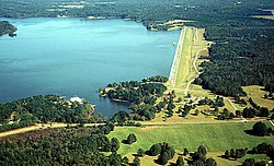
Okatibbee Dam and Lake on Okatibbee Creek, a tributary of the Chickasawhay River
The Chickasawhay River is a river, about 210 miles (340 km) long, in southeastern Mississippi in the United States. It is a principal tributary of the Pascagoula River, which flows to the Gulf of Mexico.[1] The Chickasawhay's tributaries also drain a portion of western Alabama. The name "Chickasawhay" comes from the Choctaw word chikashsha-ahi, literally "Chickasaw potato".[2]
Contents
1 Geology
2 Course
3 See also
4 References
5 External links
Geology
The Chickasawhay river is known for its abundance of fossil deposits, placed over a period of 35 million years. Dr. Mark Puckett, Chairman of the Department of Geography and Geology at the University of Southern Mississippi, has studied the area for years.[3] According to Pucket, many species of fossils from the river were the first of their kind to be studied anywhere on earth and some sealife fossils, now found worldwide, were first discovered in deposits along this river. Some species are named for local towns and landmarks.[4][5]

Chickasawhay Coral Fossil
Course
The Chickasawhay is formed by the confluence of the Chunky River and Okatibbee Creek at Enterprise in northwestern Clarke County and flows generally southward through Clarke, Wayne and Greene counties into northern George County, where it meets the Leaf River to form the Pascagoula River. The Chickasawhay flows past the towns of Stonewall, Quitman, Shubuta, Waynesboro, and Leakesville.
See also
- List of rivers of Mississippi
References
^ "Chickasawhay River". Geographic Names Information System. United States Geological Survey. Retrieved 2015-09-20..mw-parser-output cite.citation{font-style:inherit}.mw-parser-output .citation q{quotes:"""""""'""'"}.mw-parser-output .citation .cs1-lock-free a{background:url("//upload.wikimedia.org/wikipedia/commons/thumb/6/65/Lock-green.svg/9px-Lock-green.svg.png")no-repeat;background-position:right .1em center}.mw-parser-output .citation .cs1-lock-limited a,.mw-parser-output .citation .cs1-lock-registration a{background:url("//upload.wikimedia.org/wikipedia/commons/thumb/d/d6/Lock-gray-alt-2.svg/9px-Lock-gray-alt-2.svg.png")no-repeat;background-position:right .1em center}.mw-parser-output .citation .cs1-lock-subscription a{background:url("//upload.wikimedia.org/wikipedia/commons/thumb/a/aa/Lock-red-alt-2.svg/9px-Lock-red-alt-2.svg.png")no-repeat;background-position:right .1em center}.mw-parser-output .cs1-subscription,.mw-parser-output .cs1-registration{color:#555}.mw-parser-output .cs1-subscription span,.mw-parser-output .cs1-registration span{border-bottom:1px dotted;cursor:help}.mw-parser-output .cs1-ws-icon a{background:url("//upload.wikimedia.org/wikipedia/commons/thumb/4/4c/Wikisource-logo.svg/12px-Wikisource-logo.svg.png")no-repeat;background-position:right .1em center}.mw-parser-output code.cs1-code{color:inherit;background:inherit;border:inherit;padding:inherit}.mw-parser-output .cs1-hidden-error{display:none;font-size:100%}.mw-parser-output .cs1-visible-error{font-size:100%}.mw-parser-output .cs1-maint{display:none;color:#33aa33;margin-left:0.3em}.mw-parser-output .cs1-subscription,.mw-parser-output .cs1-registration,.mw-parser-output .cs1-format{font-size:95%}.mw-parser-output .cs1-kern-left,.mw-parser-output .cs1-kern-wl-left{padding-left:0.2em}.mw-parser-output .cs1-kern-right,.mw-parser-output .cs1-kern-wl-right{padding-right:0.2em}
^ Bright, William (2004). Native American Placenames of the United States. University of Oklahoma Press. p. 97. ISBN 978-0-8061-3598-4. Retrieved 14 April 2011.
^ Tisdale, David (July 8, 2016). "Puckett New Chairman of Department of Geography and Geology". University of Southern Mississippi. Retrieved July 29, 2018.
^ DiRienzo, Daniella. "This Historic River In Mississippi Is One Of The Most Important Ones In The World". Only in Your State. Only In Your State, LLC. Retrieved 29 July 2018.
^ Mississippi Public Broadcasting. "35 Million Years Down the Chickasawhay". YouTube. Mississippi Public Broadcasting. Retrieved 29 July 2018.
External links
"Chickasawhay River", Columbia Gazetteer of North America
This article related to a river in Mississippi is a stub. You can help Wikipedia by expanding it. |


