West Azerbaijan Province
West Azerbaijan Province استان آذربایجان غربی | |
|---|---|
Province | |
 Counties of West Azerbaijan Province | |
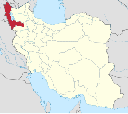 Location of West Azerbaijan Province in Iran | |
| Coordinates: 37°33′10″N 45°04′33″E / 37.5528°N 45.0759°E / 37.5528; 45.0759Coordinates: 37°33′10″N 45°04′33″E / 37.5528°N 45.0759°E / 37.5528; 45.0759 | |
| Country | |
| Region | Region 3 |
| Capital | Urmia |
| Counties | 17 |
| Government | |
| • Governor | Ghorbanali Saadat |
| • MPs of Parliament | West Azerbaijan Province parliamentary districts |
| • MPs of Assembly of Experts | Dirbaz, Ali Akbar Ghoreyshi & Mojtahed Shabestari |
| • Representative of the Supreme Leader | Mehdi Ghoreyshi |
| Area | |
| • Total | 37,437 km2 (14,455 sq mi) |
| Population (2011)[1] | |
| • Total | 3,080,576 |
| • Density | 82/km2 (210/sq mi) |
| Time zone | UTC+03:30 (IRST) |
| • Summer (DST) | UTC+04:30 (IRST) |
| Main language(s) | Persian (official) local languages: Azerbaijani[2][3][4][5] Kurdish[6][7][8][9][10] Assyrian |
HDI (2017) | 0.758[11] high · 26th |
West Azerbaijan Province[12] is one of the 31 provinces of Iran. It is in the northwest of the country, bordering Turkey, Iraq and Azerbaijan's Nakhchivan Autonomous Republic, as well as the provinces of East Azerbaijan, Zanjan and Kurdistan. The province is part of Region 3.[13] It is separated from Armenia by Turkey's short border with the Azerbaijan Republic. The province of West Azerbaijan covers an area of 39,487 km², or 43,660 km² including Lake Urmia. In 2012 the province had a population of about 3 million (estimate).[14] The capital city and largest city of the province is Urmia.
Contents
1 Archaeology
2 History
3 Geography and climate
4 Administrative divisions and cities
4.1 Cities and larger towns
5 Peoples
6 Religion
7 Culture
7.1 Colleges and universities
8 References
9 External links
Archaeology
Permanent settlements were established in the province as early as the 6th millennium BC as excavation at sites such as Teppe Hasanlu establish. In Hasanlu, a famous Golden Vase was found in 1958. The province is the location of Tepe Hajji Firuz, site of some of the world's earliest evidence of wine production.[15][16][17]Gooy Teppe is another significant site, where a metal plaque dating from 800 BC was found that depicts a scene from the Epic of Gilgamesh.
Ruins such as these and the UNESCO world heritage site at the Sasanian compound of Takht-i-Suleiman illustrate the strategic importance and tumultuous history of the province through the millennia. Overall, the province enjoys a wealth of historical attractions, with 169 sites registered by the Cultural Heritage Organization of Iran.
History

The region of the modern province as Matiene, as opposed to Atropatene to the east
The major known ancient civilization in the region was that of Mannaeans, a buffer state between Urartian and Assyrian sphere of influence. Mannaeans in turn spoke a language related to Urartian. After the fall of Assyria, the region was known as Mantiene (or Matiene) in Greek sources. Matiene bordered on Atropatene situated east of Lake Urmia.
The region is known as Vaspurakan and Nor Shirakan in Armenian history and made up an important part of historical Armenia, functioning as one of the cradles of Armenian civilisation.[18] On 26 May 451 AD, a very important battle was fought that would prove pivotal in Armenian history. On the Avarayr Plain, at what is modern-day Churs in the West Azerbaijan Province, the Armenian army under Vardan Mamikonian clashed with the Sasanian one. Although the Persians were victorious on the battlefield itself, the battle proved to be a major strategic victory for Armenians, as Avarayr paved the way to the Nvarsak Treaty (484 AD), which affirmed Armenia's right to practice Christianity freely.[19][20]
In the late 4th century AD the Sasanians incorporated the area into the neighbouring Adhurpadagan satrapy to the east.[21] The name Adhurpadagan, later Arabicized to Azerbaijan, derives from Atropates,[22][23] an Iranian satrap of Media under the Achaemenid empire, who later was reinstated as the satrap of Media under Alexander of Macedonia.[24]
At 7th century this area was under Islamic rule. After Babak Khorramdin revolted, the grip of the Abbasid caliphate weakened, allowing some native dynasties to rise. By the first half of the 11th century the Byzantine emperors were actively trying to round off their eastern territories, in an attempt to absorb the unstable Armenian dynasties. In 1021-1022 emperor Basil II led his army as far as Khoy within 175 km of Dvin, and obtained the surrender of royalty from the Artsruni dynasty of Van.[25] The Seljuk Turkic tribes, who were initially resisted by the local Hadhabani Kurds, eventually conquered the region in the 11th and early 12th centuries. During Timurid rule in the 14th century, Khoy gained an important role in all over the region. After Hadhabanis, three other Kurdish principalities, Mukriyans in southern part, Bradosti in the middle and Donboli in the northern part ruled the region for centuries, who temporarily sided with either the Ottomans or Safavids. The battle of DimDim between the Safavids and local Bradosti Kurds took place in this region. After a long and bloody siege led by the Safavid grand vizier Hatem Beg, which lasted from November 1609 to the summer of 1610, the Castle of Dimdim was captured. All the defenders were killed and Shah Abbas I ordered a general massacre in Bradost and Mukriyan (reported by Eskandar Beg, Safavid historian in the book Alam Aray-e Abbasi) and resettled the Afshar tribe in the region while deporting many Kurdish tribes to Khorasan region, where many of their descendants still reside of as of today.
The Safavid control was firmly restored by Shah Abbas but during the Afghan invasion (1722–1728) more than a century later, the Ottomans captured the northwestern regions of Iran, until Nadir Shah expelled them and reasserted Iranian suzerainty over the region and far beyond. The Russian (Tsarist) army occupied the region in 1909, and again in 1912–1914 and 1915–1918 period. The Ottomans occupied the region in 1914–1915 and 1918–1919 periods. The Soviet forces occupied the region in 1941, resulting in establishment of a short-lived, Soviet-supported puppet state called the Republic of Mahabad, from November 1945 to November 1946.
The districts of Mākū , Ḵoy, Salmās, and Arasbārān, and the region of Urmia, according to 19th century administrative division became a part of the northwestern Iranian province of Azerbaijan.[26] In 1937 the province was renamed to Shomal-e gharb (northwestern province)
Shortly after it the province of Azerbaijan was divided into a western and eastern part which were renamed to Chaharom (fourth province) and sevom (third province), respectively. In 1961 Fourth province was renamed West Azerbaijan by the Iranian authorities.
Some events in the 19th and 20th centuries are:
- Shaikh Ubeidullah Attacks, west and south of Lake Urmia in 1880;[27]
- Simko Insurrections, west of Lake Urmia from 1918 to 1922;[28]
- The Soviet occupation in 1944;
- The foundation and destruction of the Azerbaijan People's Government in 1945-1946;
- The foundation and destruction of the Republic of Mahabad in 1946 in County of Mahabad;
- Periodic severe fighting from 1979 until the 1990s near to boundaries of Iraq-Iran between Kurdish militia belonging to Kurdish political parties and the Iranian government.[29] During the early 1980s parts of the province were outside central government's control.
Geography and climate
With an area of 43,660 square kilometers, including Lake Urmia, the province of West Azerbaijan is located on the northwest of Iran.
The climate of the province is largely influenced by the rainy winds of the Atlantic Ocean and Mediterranean. Cold northern winds affect the province during winter and cause heavy snow.[30]
According to meteorological data, local temperatures vary within the province. Average temperature differs from 9.4 °C in Maku to 11.6 °C in Tekab, while it is 9.8 °C in Urmia, 10.8 °C in Khoy, 9.4 °C in Maku 11.6 °C. According to same data, the highest temperature in the province reaches 34 °C in July, and the lowest temperature is –16 °C in January. Maximum change of temperature in summer is 4 °C and in winter 15 °C. Average annual precipitation ranges from 870 millimetres (34 in) of rainfall equivalent in exposed southern areas down to around 300 millimetres (12 in) in Maku in the north,[31] of which a substantial proportion is snow.
Administrative divisions and cities
| West Azerbaijan counties |
|---|
 Lake Urmia East Azerbaijan TURKEY IRAQ Kurdistan AZERBAIJAN Maku Chaldoran Khoy Salmas Urmia Oshnaviyeh Naghadeh Miandoab Piranshahr Mahabad Bukan Shahindej Takab Sardasht |
West Azerbaijan Province is divided into seventeen counties:
- Bukan County
- Chaldoran County
- Chaypareh County
- Khoy County
- Mahabad County
- Maku County
- Miandoab County
- Naqadeh County
- Oshnavieh County
- Piranshahr County
- Poldasht County
- Salmas County
- Sardasht County
- Shahin Dezh County
- Showt County
- Takab County
- Urmia County
Cities and larger towns
| Rank | City/town | Population (2006) |
|---|---|---|
| 1. | Urmia | 583,255 |
| 2. | Khoy | 181,465 |
| 3. | Bukan | 150,703 |
| 4. | Mahabad | 135,780 |
| 5. | Miandoab | 114,153 |
| 6. | Salmas | 81,342 |
| 7. | Naqadeh | 73,438 |
| 8. | Piranshahr | 58,177 |
| 9. | Takab | 44,043 |
| 10. | Maku | 42,560 |
| 11. | Sardasht | 37,699 |
| 12. | Shahin Dezh | 34,660 |
| 13. | Oshnavieh | 30,632 |
| 14. | Qarah Zia od Din | 22,671 |
Source: Statistical Centre of Iran
Peoples
There are no official statistics or census figures on the ethnic makeup of Iran. Most of the population in West Azerbaijan Province are Azerbaijanis[2][3] and Kurds. There are three other ethnic and religious groups who are native to the province and have minority status: Armenians, Assyrians, and Jews. There are also Kurdish immigrants from neighbor province in some southern cities of the province.
The majority population of West Azerbaijan are Azerbaijanis[32][33] with 76.2 percent of the population[34] and Kurds with 21.7% percent respectively[34]Azerbaijanis live mostly in Chaldoran, Maku, Khoy, Salmas, Urmia, Naghadeh, Miandoab, Shahindej and Takab counties and Kurds inhabit mostly Oshnaviyeh, Sardasht, Mahabad, Piranshahr and Bukan counties.[6][7][8][9][10]
Religion
Some Muslim researchers[35] have proclaimed that the birth of the prophet Zoroaster was in this area, in the vicinity of Lake Orumieh, Chichest or Ganzak; recent scholarship, however, indicates that sites in Central Asia are more likely.[36]
Culture
West Azerbaijan possesses a rich culture, stemming from Azeri and Kurdish traditions. Many local traditions, such as music and dance, continue to survive among the peoples of the province. As a longstanding province of Persia, West Azerbaijan is mentioned favorably on many occasions in Persian literature by Iran's greatest authors and poets:
گزیده هر چه در ایران بزرگان
زآذربایگان و ری و گرگان
All the nobles and greats of Iran,
Choose from Azerbaijan, Ray, and Gorgan.
—Vis o Ramin
از آنجا بتدبیر آزادگان
بیامد سوی آذرآبادگان
From there the wise and the free,
set off to Azerbaijan
—Nizami
بیک ماه در آذرآبادگان
ببودند شاهان و آزادگان
For a month's time, The Kings and The Free,
Would choose in Azerbaijan to be
—Firdowsi
Colleges and universities
Urmia University was first built by an American Presbyterian missionary in 1878. A medical faculty was also established there headed by Joseph Cochran and a team of American medical associates. Cochran and his colleagues were buried in an old cemetery in the vicinity of Urmia. Urmia University website says this about them:
- "There they lie in peace away from their homeland, and the testimonial epitaphs on their tombs signify their endeavor and devotion to humanity."
The province today has the following major institutes of higher education:
Urmia University [2]
- Urmia University of Medical Sciences
- Urmia University of Technology
- Islamic Azad University of Urmia
- Islamic Azad University of Salmas
Islamic Azad University of Khoi[permanent dead link]
- Islamic Azad University of Mahabad
References
^ Selected Findings of National Population and Housing Census 2011
^ ab "Geography: Turkic-speaking Groups" Iran: A Country Study, Federal Research Division, Library of Congress, (2008)
^ ab Minahan, James (2002) Encyclopedia of the Stateless Nations: S-Z (Volume 4 of Encyclopedia of the Stateless Nations: Ethnic and National Groups Around the World) Greenwood Publishing Group, Westport, Connecticut, page 1765, .mw-parser-output cite.citation{font-style:inherit}.mw-parser-output q{quotes:"""""""'""'"}.mw-parser-output code.cs1-code{color:inherit;background:inherit;border:inherit;padding:inherit}.mw-parser-output .cs1-lock-free a{background:url("//upload.wikimedia.org/wikipedia/commons/thumb/6/65/Lock-green.svg/9px-Lock-green.svg.png")no-repeat;background-position:right .1em center}.mw-parser-output .cs1-lock-limited a,.mw-parser-output .cs1-lock-registration a{background:url("//upload.wikimedia.org/wikipedia/commons/thumb/d/d6/Lock-gray-alt-2.svg/9px-Lock-gray-alt-2.svg.png")no-repeat;background-position:right .1em center}.mw-parser-output .cs1-lock-subscription a{background:url("//upload.wikimedia.org/wikipedia/commons/thumb/a/aa/Lock-red-alt-2.svg/9px-Lock-red-alt-2.svg.png")no-repeat;background-position:right .1em center}.mw-parser-output .cs1-subscription,.mw-parser-output .cs1-registration{color:#555}.mw-parser-output .cs1-subscription span,.mw-parser-output .cs1-registration span{border-bottom:1px dotted;cursor:help}.mw-parser-output .cs1-hidden-error{display:none;font-size:100%}.mw-parser-output .cs1-visible-error{font-size:100%}.mw-parser-output .cs1-subscription,.mw-parser-output .cs1-registration,.mw-parser-output .cs1-format{font-size:95%}.mw-parser-output .cs1-kern-left,.mw-parser-output .cs1-kern-wl-left{padding-left:0.2em}.mw-parser-output .cs1-kern-right,.mw-parser-output .cs1-kern-wl-right{padding-right:0.2em}
ISBN 978-0-313-32384-3
^ Price, Glanville (editor) (2000) Encyclopedia of the languages of Europe Wiley-Blackwell, Oxford, England, page 21,
ISBN 978-0-631-22039-8
^ Shaffer, Brenda (2002) Borders and brethren: Iran and the challenge of Azarbaijani identity, MIT Press, Cambridge, Massachusetts, page 1,
ISBN 978-0-262-69277-9
^ ab گنجینه ای بنام آذربایجانغربی - سازمان تعزیرات حکومتی (The government suspended) Farsi
^ ab معرفی آذربایجان غربی - پورتال جامع آذربایجان غربی (Farsi & English)
^ ab آذربایجان غربی ؛ رنگین کمان اقوام و اقلیت ها در مسیر توسعه - مهر نیوز Mehr News (Farsi)
^ ab گردشگری استان - سازمان نظام کاردانی ساختمان استان آذربایجان غربی (Farsi)
^ ab استان آذربایجان غربی - سايت جامع گردشگري ايران (Farsi)
^ "Sub-national HDI - Area Database - Global Data Lab". hdi.globaldatalab.org. Retrieved 2018-09-13.
^ Locally, "West Azerbaijan Province" is written: Persian: استان آذربایجان غربی; Azerbaijani: غربی آذربایجان اوستانی
^ "همشهری آنلاین-استانهای کشور به ۵ منطقه تقسیم شدند (Provinces were divided into 5 regions)". Hamshahri Online (in Persian). 22 June 2014. Archived from the original on 23 June 2014.
^ "Azarbayejān-e Gharbi". World Gazetteer. Archived from the original on 30 September 2007.
^ "Penn Museum - University of Pennsylvania Museum of Archaeology and Anthropology". Archived from the original on 2008-12-16.
^ Voigt, Mary M. and Meadow, Richard H. (1983) Hajji Firuz Tepe, Iran: the neolithic settlement University Museum, University of Pennsylvania, Philadelphia, Pennsylvania,
ISBN 0-934718-49-0
^ Bert G. Fragner, ‘Soviet Nationalism’: An Ideological Legacy to the Independent Republics of Central Asia ’ in” in Van Schendel, Willem(Editor) . Identity Politics in Central Asia and the Muslim World: Nationalism, Ethnicity and Labour in the Twentieth Century. London , GBR: I. B. Tauris & Company, Limited, 2001. Excerpt from pg 24: "Under Soviet auspices and in accordance with Soviet nationalism, historical Azerbaijan proper was reinterpreted as 'Southern Azerbaijan', with demands for liberation and, eventually, for 're'-unification with Northern (Soviet) Azerbaijan a breathtaking manipulation. No need to point to concrete Soviet political activities in this direction, as in 1945–46 etc. The really interesting point is that in the independent former Soviet republics this typically Soviet ideological pattern has long outlasted the Soviet Union."
^ Hovannisian, Richard G. (1999). Armenian Van/Vaspurakan. Costa Mesa, California: Mazda Publishers. ISBN 1-56859-130-6. Archived from the original on 2011-06-08. Retrieved 2011-01-22.
^ Hewsen, Robert H. (August 17, 2011). "AVARAYR". Encyclopædia Iranica.So spirited was the Armenian defense, however, that the Persians suffered enormous losses as well. Their victory was pyrrhic and the king, faced with troubles elsewhere, was forced, at least for the time being, to allow the Armenians to worship as they chose.
^ Susan Paul Pattie (1997). Faith in History: Armenians Rebuilding Community. Smithsonian Institution Press. p. 40. ISBN 1560986298.The Armenian defeat in the Battle of Avarayr in 451 proved a pyrrhic victory for the Persians. Though the Armenians lost their commander, Vartan Mamikonian, and most of their soldiers, Persian losses were proportionately heavy, and Armenia was allowed to remain Christian.
^ Richard G. Hovannisian, 2004, The Armenian People From Ancient to Modern Times, Volume I: The Dynastic Periods: From Antiquity to the Fourteenth Century, Palgrave Macmillan,
ISBN 1-4039-6421-1,
ISBN 978-1-4039-6421-2, p. 92
^ Minorsky, V.; Minorsky, V. Ādharbaydjān (Azerbāydjān). Encyclopaedia of Islam. Edited by P. Bearman, Th. Bianquis, C. E. Bosworth, E. van Donzel and W. P. Heinrichs. Brill, 2007. Brill Online. [1][dead link]
^ Encyclopædia Iranica, "Azerbaijan: Pre-Islamic History", K. Shippmann
^ Historical Dictionary of Azerbaijan by Tadeusz Swietochowski and Brian C. Collins. The Scarecrow Press, Inc., Lanham, Maryland (1999),
ISBN 0-8108-3550-9 (retrieved 7 June 2006)
^ Minorsky, Vladimir (1953) Studies in Caucasian History I. New Light on the Shaddadids of Ganja II. The Shaddadids of Ani III. Prehistory of Saladin page 52, CUP Archive, 1 jan. 1953
ISBN 978-0521057356
^ Ehsan Yar-Shater, 1982, Encyclopaedia Iranica: publisher: Routledge & Kegan Paul, University of California, Volume 2, Issues 5-8, p. 476
^ The Kurdish Question, by W. G. Elphinston, Journal of International Affairs, Royal Institute of International Affairs, 1946, p.94
^ The Kurdish Question, by W. G. Elphinston, Journal of International Affairs, Royal Institute of International Affairs, 1946, p.97
^ "Iran - Kurds".
^ "Azerbaijan". Encyclopædia Britannica.
^ See Iranian Meteorological Agency
^ Azerbaijanis (author Brenda Shaffer), page 206. // Encyclopaedia of Modern Asia. Volume 1: Abacus to China. Editors: David Levinson and Karen Christensen. New York: Charles Scribner's Sons, 2002, LXVII+ 529 pages.
ISBN 9780684312422 "Iran’s three northwesternmost provinces are inhabited predominantly by Azerbaijanis: East Azerbaijan, West Azerbaijan, and Ardabil. Tehran, the capital city, has a large Azerbaijani population as well, estimated at close to 50 percent of the city’s residents."
^ Federal Research Division, 2004, Iran A Country Study, Kessinger Publishing,
ISBN 1-4191-2670-9,
ISBN 978-1-4191-2670-3, p. 121, "The Azeri area of Iran includes most of West Azarbaijan"
^ abc General Culture Council of Islamic Republic of Iran for West Azerbaijan province: فهرست نویسی پیش از انتشار کتابخانه ملی جمهوری اسلامی ایران * شماره کتابشناسه ملّی:۲۸۹۰۶۹۰ *عنوان و نام پدیدآورنده:طرح بررسی و سنجش شاخص های فرهنگ عمومی کشور(شاخص های غیرثبتی){گزارش}:گزارش های پیشرفت طرح ها وکلان شهرها/به سفارش شورای فرهنگ عمومی کشور؛مدیر طرح و مسئول سیاست گذاری:منصور واعظی؛اجرا:شرکت پژوهشگران خبره پارس *بهاء:۱۰۰۰۰۰ ریال-شابک:۷-۶۸-۶۶۲۷-۶۰۰-۹۷۸ *وضعیت نشر:تهران-موسسه انتشارات کتاب نشر ۱۳۹۱ *وضعیت ظاهری:۲۹۵ ص:جدول(بخش رنگی)،نمودار(بخش رنگی)*یادداشت:عنوان دیگر:طرح و بررسی و سنجش شاخص های فرهنگ عمومی کشور(شاخص های غیرثبتی) سال ۱۳۸۹ *توصیفگر:شاخص های غیرثبتی+شاخص های فرهنگی+گزارش های پیشرفت طرح ها و کلان شهرها *توصیفگر:ایران ۳۸۶۲۸۹ *تهران۱۹۹۰۶۶ /مشهد۲۹۲۳۴۱ /اصفهان ۱۷۰۰۱۷/تبریز۱۸۴۸۱/کرج ۲۷۸۲۵۲/شیراز۲۵۱۷۰۳/اهواز۱۷۶۴۰۳/قم۲۷۰۸۷۷ *شناسنامه افزوده:واعظی،منصور،۱۳۳۳-۷۳۵۰۶۸ *شناسنامه افزوده:شرکت پژوهشگران خبره پارس /شورای فرهنگ عمومی *مرکز پخش:خیابان ولیعصر،زرتشت غربی،خیابان کامبیز،بخش طباطبایی رفیعی،پلاک۱۸،تلفن:۷-۸۸۹۷۸۴۱۵ *لیتوگرافی،چاپ وصحافی:سازمان چاپ و انتشارات اوقاف , (German)Titel: Der Plan um Untersuchungen und Auswertungen der Indikatoren der generellen Kultur des Landes,
ISBN 978-600-6627-68-7, Jahr der Veröffentlichung: 2012, Verlag: Ketabe Nashr |language=Persian
^ Balādâorī and Ebn Kordādâbeh
^ "As a matter of fact, only untrustworthy and late traditions place Zoroaster's birthplace at Urmia." Tarbiyat, Muḥammad Ali (1935) Dānishmandān-i Āzarbayjān Tehran, p. 162, reissued in 1999,
ISBN 964-422-138-9
External links
| Wikimedia Commons has media related to West Azerbaijan province. |
- Official website of West Azerbaijan Governor’s Office
- West Azerbaijan’s Government Portal
- Urmia sport news agency
- West Azerbaijan Provincial Management Organization
- West Azerbaijan Cultural Heritage Organization
- Recent photos from Azerbaijan
- Lake Urmia UNESCO Biosphere Reserve
Places adjacent to West Azerbaijan Province | ||||||||||
|---|---|---|---|---|---|---|---|---|---|---|
| ||||||||||
List of cities, towns and villages in West Azerbaijan Province | ||
| Capital |
|  |
Counties and cities |
| |
| Tourism |
| |
| Places | List of cities, towns and villages in West Azerbaijan Province | |
Provinces of Iran | ||
|---|---|---|
| ||
Authority control |
|
|---|


