Tumlong
Tumlong | |
|---|---|
Village | |
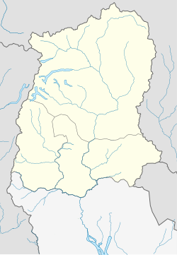
 Tumlong Location in Sikkim, India Show map of Sikkim  Tumlong Tumlong (India) Show map of India | |
| Coordinates: 27°25′N 88°35′E / 27.42°N 88.58°E / 27.42; 88.58Coordinates: 27°25′N 88°35′E / 27.42°N 88.58°E / 27.42; 88.58 | |
| Country | |
| State | Sikkim |
| District | North Sikkim |
| Elevation | 1,473 m (4,833 ft) |
| Population (2011) | |
| • Total | 425 |
| Languages | |
| • Official | Nepali, Bhutia, Lepcha, Limbu, Newari, Rai, Gurung, Mangar, Sherpa, Tamang and Sunwar |
| Time zone | UTC+5:30 (IST) |
| Vehicle registration | SK |
Tumlong is a village in the Indian state of Sikkim in northwestern India. It is located in the Mangan sub division of North Sikkim district and was historically the third capital of Kingdom of Sikkim.
Contents
1 History
2 Geography
3 People
4 Services
4.1 Education
4.2 Healthcare
5 Historical Photographs
6 References
History
In 1894, Thutob Namgyal, the chogyal (monarch) shifted the capital of Sikkim from Tumlong to the current capital of Gangtok. Tumlong was the third capital after Yuksom and Rabdentse close to Nepal. After repeated raids, the capital was shifted to Tumlong, further inland, in 1793 by Tshudpud Namgyal. The Treaty of Tumlong was signed here in 1861 between the British and the Sikkim Rajah. [1]
Geography
Tumlong is located at 27°25′N 88°35′E / 27.42°N 88.58°E / 27.42; 88.58.[2] It has an average elevation of 1,473 metres (4,833 feet).
People
Many of the village's men are monks at the Buddhist monastery that rests at the top of the village. The villagers speak Sikkimese, Nepali and Hindi. According to the 2011 census, the village's population is 425. The literacy rate is 78.28% compared to 81.42% for the district.[3]
Services
Education
Tumlong has an elementary school and is a short walk from a high school.
Healthcare
In Tumlong (specifically in Phodong under the same gram panchayat) there is a Primary Health Centre (PHC) with two residential doctors and a staff including nurses.
Historical Photographs

Buddhist Procession

Prayer Wheels

Buddhist Monastery

The Palace of Tumlong
References
^ "Archived copy" (PDF). Archived from the original (PDF) on 2013-10-29. Retrieved 2013-10-28.CS1 maint: Archived copy as title (link) .mw-parser-output cite.citation{font-style:inherit}.mw-parser-output q{quotes:"""""""'""'"}.mw-parser-output code.cs1-code{color:inherit;background:inherit;border:inherit;padding:inherit}.mw-parser-output .cs1-lock-free a{background:url("//upload.wikimedia.org/wikipedia/commons/thumb/6/65/Lock-green.svg/9px-Lock-green.svg.png")no-repeat;background-position:right .1em center}.mw-parser-output .cs1-lock-limited a,.mw-parser-output .cs1-lock-registration a{background:url("//upload.wikimedia.org/wikipedia/commons/thumb/d/d6/Lock-gray-alt-2.svg/9px-Lock-gray-alt-2.svg.png")no-repeat;background-position:right .1em center}.mw-parser-output .cs1-lock-subscription a{background:url("//upload.wikimedia.org/wikipedia/commons/thumb/a/aa/Lock-red-alt-2.svg/9px-Lock-red-alt-2.svg.png")no-repeat;background-position:right .1em center}.mw-parser-output .cs1-subscription,.mw-parser-output .cs1-registration{color:#555}.mw-parser-output .cs1-subscription span,.mw-parser-output .cs1-registration span{border-bottom:1px dotted;cursor:help}.mw-parser-output .cs1-hidden-error{display:none;font-size:100%}.mw-parser-output .cs1-visible-error{font-size:100%}.mw-parser-output .cs1-subscription,.mw-parser-output .cs1-registration,.mw-parser-output .cs1-format{font-size:95%}.mw-parser-output .cs1-kern-left,.mw-parser-output .cs1-kern-wl-left{padding-left:0.2em}.mw-parser-output .cs1-kern-right,.mw-parser-output .cs1-kern-wl-right{padding-right:0.2em}
^ Falling Rain Genomics, Inc - Tumlong
^ "Tumlong Village Population - Mangan - North Sikkim, Sikkim". www.census2011.co.in. Retrieved 2018-07-19.
This article related to a location in the Indian state of Sikkim is a stub. You can help Wikipedia by expanding it. |


