Sande, Vestfold
Sande kommune | |||
|---|---|---|---|
Municipality | |||
| |||
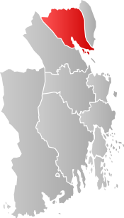 Sande within Vestfold | |||
| Coordinates: 59°35′50″N 10°13′25″E / 59.59722°N 10.22361°E / 59.59722; 10.22361Coordinates: 59°35′50″N 10°13′25″E / 59.59722°N 10.22361°E / 59.59722; 10.22361 | |||
| Country | Norway | ||
| County | Vestfold | ||
| Administrative centre | Sande i Vestfold | ||
| Government | |||
| • Mayor (2015-) | Elin Gran Weggesrud (Ap) | ||
| Area | |||
| • Total | 178 km2 (69 sq mi) | ||
| • Land | 174 km2 (67 sq mi) | ||
| Area rank | #346 in Norway | ||
| Population (2018) | |||
| • Total | 9,805 | ||
| • Rank | #128 in Norway | ||
| • Density | 44/km2 (110/sq mi) | ||
| • Change (10 years) | 9.3% | ||
| Demonym(s) | Sandesokning[1] | ||
| Time zone | UTC+01:00 (CET) | ||
| • Summer (DST) | UTC+02:00 (CEST) | ||
| ISO 3166 code | NO-0713 | ||
| Official language form | Bokmål | ||
| Website | www.sande-ve.kommune.no | ||
Data from Statistics Norway | |||


Sande is a municipality in Vestfold County, Norway. Its administrative centre is the village of Sande i Vestfold. The municipality of Sande was established on 1 January 1838 (see formannskapsdistrikt).
Sande is located in a beautiful area by the sea about 60 kilometres (37 mi) south of Oslo (50 minutes driving time). In recent years the administrative center of Sande has grown significantly due to a large number of new apartments and stores.
Portions of the 1973 Olsenbanden movie Olsenbanden tar gull from were filmed in Sande. Another portion was filmed Stavern.
Contents
1 General information
1.1 Name
1.2 Coat-of-arms
2 Geography
3 Media
4 Sande Church
5 Sister cities
6 Famous inhabitants
7 References
8 External links
General information
Name
The municipality (originally the parish) is named after the old Sande farm (Old Norse: Sandvin) because the first church was built there. The first element in the name, sandr, means "sand", and the last element, vin, means "meadow" or "pasture".[2]
Coat-of-arms
The coat-of-arms is from modern times. It was granted on 19 December 1986, and it represents silver-colored Sandebukta bay, with its typical shape, surrounded by forests and mountains.[3]
Geography
Presteseteråsen (568 m.) is located in westernmost Sande municipality and is the highest point in Sande.[4]
Media
The newspaper Sande Avis is published in Sande.[5]

Sande Church in Vestfold
Sande Church
Sande in Vestfold is the site of the medieval era Sande Church (Sande kirke, Vestfold). It is located in Sande parish in Nord-Jarlsberg rural deanery. The building material is stone and brick, and it was built in 1150. In 1783, the church burned down; only the walls remained. Over the next eight years, it was rebuilt, and 1860 the church was refurnished. But the older altarpiece, baptismal font, and pulpit were retained. The pulpit is also from 1783 and features Rococo-style carvings. The font of soapstone is the only medieval inventory preserved. [6][7]
Sister cities
The following cities are twinned with Sande:[8]
 Akaa, Western Finland, Finland
 Klippan, Skåne County, Sweden
Famous inhabitants
Carl I. Hagen, former Vice President of the Norwegian Parliament and chairman of the Progress Party from 1978 until 2006.
Rune Høydahl, former silver medalist in the World Mountain Bike Championship
References
^ "Navn på steder og personer: Innbyggjarnamn" (in Norwegian). Språkrådet. Retrieved 2015-12-01..mw-parser-output cite.citation{font-style:inherit}.mw-parser-output q{quotes:"""""""'""'"}.mw-parser-output code.cs1-code{color:inherit;background:inherit;border:inherit;padding:inherit}.mw-parser-output .cs1-lock-free a{background:url("//upload.wikimedia.org/wikipedia/commons/thumb/6/65/Lock-green.svg/9px-Lock-green.svg.png")no-repeat;background-position:right .1em center}.mw-parser-output .cs1-lock-limited a,.mw-parser-output .cs1-lock-registration a{background:url("//upload.wikimedia.org/wikipedia/commons/thumb/d/d6/Lock-gray-alt-2.svg/9px-Lock-gray-alt-2.svg.png")no-repeat;background-position:right .1em center}.mw-parser-output .cs1-lock-subscription a{background:url("//upload.wikimedia.org/wikipedia/commons/thumb/a/aa/Lock-red-alt-2.svg/9px-Lock-red-alt-2.svg.png")no-repeat;background-position:right .1em center}.mw-parser-output .cs1-subscription,.mw-parser-output .cs1-registration{color:#555}.mw-parser-output .cs1-subscription span,.mw-parser-output .cs1-registration span{border-bottom:1px dotted;cursor:help}.mw-parser-output .cs1-hidden-error{display:none;font-size:100%}.mw-parser-output .cs1-visible-error{font-size:100%}.mw-parser-output .cs1-subscription,.mw-parser-output .cs1-registration,.mw-parser-output .cs1-format{font-size:95%}.mw-parser-output .cs1-kern-left,.mw-parser-output .cs1-kern-wl-left{padding-left:0.2em}.mw-parser-output .cs1-kern-right,.mw-parser-output .cs1-kern-wl-right{padding-right:0.2em}
^ Rygh, Oluf (1907). Norske gaardnavne: Jarlsberg og Larviks amt (in Norwegian) (6 ed.). Kristiania, Norge: W. C. Fabritius & sønners bogtrikkeri. p. 26.
^ Norske Kommunevåpen (1990). "Nye kommunevåbener i Norden". Retrieved 2009-01-14.
^ Larsen, Erlend (2011). På Tur i Vestfold del 2. E-forlag. Page 196.
ISBN 9788293057222.
^ Store norske leksikon: Sande Avis.
^ "Sande kirke, Vestfold". Den Norske Kirke. Retrieved October 1, 2016.
^ "Sande kirkested". Kulturminnesok.no. Archived from the original on 2014-01-11. Retrieved October 1, 2016.
^ "Om Sande". Sande kommune. Retrieved 2009-01-14.
[dead link](in Norwegian)
External links
 Media related to Sande, Vestfold at Wikimedia Commons
 The dictionary definition of Sande at Wiktionary
Municipal fact sheet from Statistics Norway
Municipalities of Vestfold | ||
|---|---|---|
| ||


