Hurricane, West Virginia
Hurricane, West Virginia | |
|---|---|
City | |
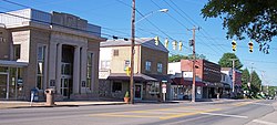 Main Street in Hurricane in 2007 | |
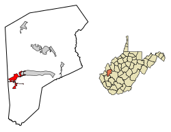 Location of Hurricane in Putnam County, West Virginia. | |
| Coordinates: 38°25′57″N 82°1′11″W / 38.43250°N 82.01972°W / 38.43250; -82.01972Coordinates: 38°25′57″N 82°1′11″W / 38.43250°N 82.01972°W / 38.43250; -82.01972 | |
| Country | United States |
| State | West Virginia |
| County | Putnam |
| Government | |
| • Type | Mayor-Council |
| • Mayor | Scott Edwards |
| Area [1] | |
| • Total | 3.78 sq mi (9.78 km2) |
| • Land | 3.74 sq mi (9.70 km2) |
| • Water | 0.03 sq mi (0.08 km2) |
| Elevation | 705 ft (215 m) |
| Population (2010)[2] | |
| • Total | 6,284 |
| • Estimate (2017)[3] | 6,542 |
| • Density | 1,747.33/sq mi (674.70/km2) |
| Time zone | UTC-5 (Eastern (EST)) |
| • Summer (DST) | UTC-4 (EDT) |
| ZIP code | 25526 |
| Area code(s) | 304,681 |
| FIPS code | 54-39532[4] |
GNIS feature ID | 1554759[5] |
| Website | http://www.hurricanewv.com/ |
Hurricane /ˈhɜːrɪkɪn/[6] is a city in Putnam County, West Virginia, in the United States. The population was 6,284 at the 2010 census.[7]
Hurricane is a part of the Huntington-Ashland, WV-KY-OH, Metropolitan Statistical Area (MSA). As of the 2010 census, the MSA had a population of 287,702. New definitions from February 28, 2013 placed the population at 363,000.[8]
Contents
1 History
2 Geography
3 Demographics
3.1 2010 census
3.2 2000 census
4 Harrah Organ
5 Notable people
6 References
7 External links
History
Hurricane was named after Hurricane Creek, which was, in turn, named after a group of trees at the arm of the river bent in one direction. A party of surveyors commissioned by George Washington noted the site appeared to have been struck by a hurricane,[9] giving rise to the name. Locals pronounce the town (HURR-i-KINN) not (HURR-i-CANE).[10] Less than 17 miles (27 km) southeast of Hurricane is a post office named Tornado.
A town named Hurricane Bridge was located where West Virginia Route 34 now crosses the creek, near current-day Hurricane. The town can be traced back to an 1811 Virginia map. The town primarily consisted of a large Inn. On March 28, 1863, Union and Confederate forces fought a Civil War battle at Hurricane Bridge, now known as the skirmish at Hurricane Bridge.[11]
Hurricane itself can be traced back to 1873, when a railroad track was laid through the town and a small depot was constructed. It was during this period that Main Street developed, along with other businesses in the area. Hurricane was a trading and residential town for tobacco growers and other farmers in the early 1900s. The fire department was established March 2, 1936. It was incorporated as a town in 1889, and as a city in the 1970s.
The three oldest continuously operating businesses are:
- The Hurricane Breeze, a weekly newspaper established October 1900.
- Putnam County Bank, established October 25, 1901.
- Rappold's Barber Shop, established June 1906.
In the early 1990s, the old depot, which once served as the catalyst for the town's development, was torn down and replaced with a small gazebo. It was also during the 1990s that the city began to see a surge in urban growth as several subdivisions were established in the city limits. The population increase resulted in the widening of Route 34, a connecting road to Teays Valley, and an expansion of Hurricane High School.
In 2002, a winning multi-state Powerball ticket was sold at a convenience store in Teays Valley near the city of Hurricane. The winning ticketholder was Jack Whittaker. At the time it was the largest jackpot ever won by a single winning ticket in the history of American lottery.
Geography
Hurricane is located at 38°25′57″N 82°1′11″W / 38.43250°N 82.01972°W / 38.43250; -82.01972 (38.432483, -82.019718).[12]
According to the United States Census Bureau, the city has a total area of 3.77 square miles (9.76 km2), of which, 3.74 square miles (9.69 km2) is land and 0.03 square miles (0.08 km2) is water.[13] Hurricane is also unique as it sits on a very active rift.
Demographics
| Historical population | |||
|---|---|---|---|
| Census | Pop. | %± | |
| 1880 | 67 | — | |
| 1890 | 207 | 209.0% | |
| 1900 | 240 | 15.9% | |
| 1910 | 422 | 75.8% | |
| 1920 | 666 | 57.8% | |
| 1930 | 1,293 | 94.1% | |
| 1940 | 1,103 | −14.7% | |
| 1950 | 1,463 | 32.6% | |
| 1960 | 1,970 | 34.7% | |
| 1970 | 3,491 | 77.2% | |
| 1980 | 3,751 | 7.4% | |
| 1990 | 4,461 | 18.9% | |
| 2000 | 5,222 | 17.1% | |
| 2010 | 6,284 | 20.3% | |
| Est. 2017 | 6,542 | [3] | 4.1% |
| Source:[14] | |||
2010 census
As of the census[2] of 2010, there were 6,284 people, 2,499 households, and 1,785 families residing in the city. The population density was 1,680.2 inhabitants per square mile (648.7/km2). There were 2,627 housing units at an average density of 702.4 per square mile (271.2/km2). The racial makeup of the city was 96.7% White, 1.0% African American, 0.2% Native American, 0.7% Asian, 0.2% from other races, and 1.2% from two or more races. Hispanic or Latino of any race were 0.9% of the population.
There were 2,499 households of which 35.2% had children under the age of 18 living with them, 55.0% were married couples living together, 12.2% had a female householder with no husband present, 4.2% had a male householder with no wife present, and 28.6% were non-families. 24.7% of all households were made up of individuals and 9.5% had someone living alone who was 65 years of age or older. The average household size was 2.51 and the average family size was 3.00.
The median age in the city was 38.1 years. 25.5% of residents were under the age of 18; 6.9% were between the ages of 18 and 24; 27.5% were from 25 to 44; 26.6% were from 45 to 64; and 13.5% were 65 years of age or older. The gender makeup of the city was 47.9% male and 52.1% female.
2000 census
As of the census[4] of 2000, there were 5,222 people, 2,098 households, and 1,518 families residing in the city. The population density was 1,765.0 people per square mile (681.2/km²). There were 2,258 housing units at an average density of 763.2 per square mile (294.5/km²). The racial makeup of the city was 98.12% White, 0.67% African American, 0.08% Native American, 0.38% Asian, 0.10% from other races, and 0.65% from two or more races. Hispanic or Latino of any race were 0.54% of the population.
There were 2,098 households out of which 34.4% had children under the age of 18 living with them, 59.2% were married couples living together, 10.1% had a female householder with no husband present, and 27.6% were non-families. 24.8% of all households were made up of individuals and 9.6% had someone living alone who was 65 years of age or older. The average household size was 2.49 and the average family size was 2.98.
In the city, the population was spread out with 25.2% under the age of 18, 8.4% from 18 to 24, 30.8% from 25 to 44, 23.1% from 45 to 64, and 12.6% who were 65 years of age or older. The median age was 36 years. For every 100 females, there were 92.6 males. For every 100 females age 18 and over, there were 89.0 males.
The median income for a household in the city was $39,591, and the median income for a family was $43,155. Males had a median income of $34,808 versus $22,972 for females. The per capita income for the city was $20,119. About 8.2% of families and 10.3% of the population were below the poverty line, including 14.6% of those under age 18 and 8.3% of those age 65 or over.
Harrah Organ
Hurricane has a massive, 6-manual hybrid pipe organ (a combination of pipes and digital voices) with 456 stops, located at the Forrest Burdette Memorial United Methodist Church. Built by Allen Harrah, formerly with Rodgers Organs, it was inaugurated on September 28, 2003.[15] A concert series featuring notable organists from around the U.S., such as Frederick Swann, Paul Jacobs, Isabelle Demers (Canada), and Hector Olivera, is an ongoing feature.[16][17]
Notable people
John "Doc" Holliday, head football coach, Marshall University
Alex Wilson, MLB relief pitcher, Detroit Tigers (World Series victory 2013 with Boston Red Sox)
Christopher Workman,
City of hurricane street department 2016-2019, WV State Road 2019-present
Ezra Thornton,Austrian born Formula Ford driver, resident of Hurricane.
References
^ "2017 U.S. Gazetteer Files". United States Census Bureau. Retrieved Mar 27, 2019..mw-parser-output cite.citation{font-style:inherit}.mw-parser-output .citation q{quotes:"""""""'""'"}.mw-parser-output .citation .cs1-lock-free a{background:url("//upload.wikimedia.org/wikipedia/commons/thumb/6/65/Lock-green.svg/9px-Lock-green.svg.png")no-repeat;background-position:right .1em center}.mw-parser-output .citation .cs1-lock-limited a,.mw-parser-output .citation .cs1-lock-registration a{background:url("//upload.wikimedia.org/wikipedia/commons/thumb/d/d6/Lock-gray-alt-2.svg/9px-Lock-gray-alt-2.svg.png")no-repeat;background-position:right .1em center}.mw-parser-output .citation .cs1-lock-subscription a{background:url("//upload.wikimedia.org/wikipedia/commons/thumb/a/aa/Lock-red-alt-2.svg/9px-Lock-red-alt-2.svg.png")no-repeat;background-position:right .1em center}.mw-parser-output .cs1-subscription,.mw-parser-output .cs1-registration{color:#555}.mw-parser-output .cs1-subscription span,.mw-parser-output .cs1-registration span{border-bottom:1px dotted;cursor:help}.mw-parser-output .cs1-ws-icon a{background:url("//upload.wikimedia.org/wikipedia/commons/thumb/4/4c/Wikisource-logo.svg/12px-Wikisource-logo.svg.png")no-repeat;background-position:right .1em center}.mw-parser-output code.cs1-code{color:inherit;background:inherit;border:inherit;padding:inherit}.mw-parser-output .cs1-hidden-error{display:none;font-size:100%}.mw-parser-output .cs1-visible-error{font-size:100%}.mw-parser-output .cs1-maint{display:none;color:#33aa33;margin-left:0.3em}.mw-parser-output .cs1-subscription,.mw-parser-output .cs1-registration,.mw-parser-output .cs1-format{font-size:95%}.mw-parser-output .cs1-kern-left,.mw-parser-output .cs1-kern-wl-left{padding-left:0.2em}.mw-parser-output .cs1-kern-right,.mw-parser-output .cs1-kern-wl-right{padding-right:0.2em}
^ ab "American FactFinder". United States Census Bureau. Retrieved 2013-01-24.
^ ab "Population and Housing Unit Estimates". Retrieved March 24, 2018.
^ ab "American FactFinder". United States Census Bureau. Archived from the original on 2013-09-11. Retrieved 2008-01-31.
^ "US Board on Geographic Names". United States Geological Survey. 2007-10-25. Retrieved 2008-01-31.
^ Local residents pronounce the last syllable of the town name approximately like "kin," not "cane" (such as a hurricane, for which the standard American English pronunciation is used).
^ "Profile of General Population and Housing Characteristics: 2010 Demographic Profile Data (DP-1): Hurricane city, West Virginia". U.S. Census Bureau, American Factfinder. Archived from the original on September 11, 2013. Retrieved November 28, 2011.
^ "Population statistics" (PDF). Archived from the original (PDF) on 2013-03-19.
^ ::City of Hurricane::
^ City of Hurricane Welcome Videos
^ Skirmish at Hurricane Bridge
^ "US Gazetteer files: 2010, 2000, and 1990". United States Census Bureau. 2011-02-12. Retrieved 2011-04-23.
^ "US Gazetteer files 2010". United States Census Bureau. Archived from the original on 2011-02-20. Retrieved 2013-01-24.
^ "Census of Population and Housing". U.S. Census Bureau. Retrieved 3 June 2015.
^ Hapney, Jr., Terry L. (August 26, 2016). "Organ more than a pipe dream at Hurricane church". The Herald-Dispatch. Retrieved 2018-08-03.
^ Schwarz, Bob (September 21, 2003). "Charleston native donates time, money, expertise to bring $1 million instrument". Sunday Gazette-Mail. Retrieved 2018-08-03.
^ "Archive - Community Concert Schedule". pipesounds.org. 2017. Retrieved 2018-08-04.
External links
- City of Hurricane official website
Municipalities and communities of Putnam County, West Virginia, United States | ||
|---|---|---|
County seat: Winfield | ||
| Cities |
|  |
| Towns |
| |
| CDPs |
| |
| Other localities |
| |
| Footnotes | ‡This populated place also has portions in an adjacent county or counties | |


