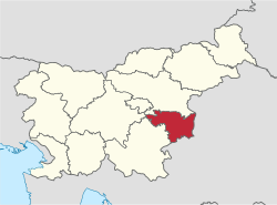
Lower Sava Statistical Region
Lower Sava Statistical Region Posavska statistična regija | |
|---|---|
Statistical region | |
 | |
| Municipalities | 4 |
| Largest town | Krško |
| Area | |
| • Total | 968 km2 (374 sq mi) |
| Population (2015) | |
| • Total | 75,727 |
| • Density | 78/km2 (200/sq mi) |
| Statistics | |
| • Households | 30147 |
| • Employed | 23414 |
| • Registered unemployed | 4695 |
| • College/university students | 3019 |
| • Regional GDP: | EUR 1.079 bn (EUR 15,409 per capita |
The Lower Sava Statistical Region[1][2][3][4][5] (Slovene: Posavska statistična regija; until December 31, 2014 Spodnjeposavska statistična regija) is a statistical region in Slovenia. It has good traffic accessibility and is located in the Sava and Krka Valleys, with hilly areas with vineyards and an abundance of water. It is the second-smallest statistical region in Slovenia. The only nuclear power plant in the country and Čatež spa are located in the region. The region annually spends EUR 22 million on environmental protection. In 2013, the employment rate in the region was 57.5%. The region was characterized by the largest difference between the employment rate for men and for women (for men it was 12 percentage points higher than for women). In 2013 this region also stood out in number of convicted persons per 1,000 population (8.3).
Contents
1 Municipalities
2 Demographics
3 Economy
3.1 Tourism
4 Transportation
5 Sources
Municipalities
The Lower Sava Statistical Region comprises six municipalities:
- Bistrica ob Sotli
- Brežice
- Kostanjevica na Krki
- Krško
- Radeče
- Sevnica
Demographics
The population in 2015 was 75,727. It has a total area of 968 square kilometers (374 sq mi).
Economy
Employment structure: 45.8% services, 50% industry, 4.2% agriculture.
Tourism
It attracts 5.1% of the total number of tourists in Slovenia, most being from Slovenia (53%).
Transportation
- Length of motorways: 36.6 kilometers (22.7 mi)
- Length of other roads: 2,346.3 kilometers (1,457.9 mi)
Sources
^ Žibert, Mojca. 2014. Energetika v Spodnjeposavski statistični regiji (bachelor's thesis). Ljubljana: University of Ljubljana, Department of Geography, p. 37.
^ OECD. 2012. OECD Environmental Performance Reviews: Slovenia 2012. OECD Publishing, p. 324.
^ Lapuh, Lucija. 2016. Measuring the Impact of the Recession on Slovenian Statistical Regions and their Ability to Recover. Acta geographica Slovenica 56(2): 247–256, pp. 252ff.
^ Šprah, Lilijana, Tatjana Novak, & Jerneja Fridl. 2016. The Wellbeing of Slovenia's Population by Region: Comparison of Indicators with an Emphasis on Health. Acta geographica Slovenica 54(1): 67–87, p. 68.
^ Boršič, Darja, & Alenka Kavkler. 2009. Modeling Unemployment Duration in Slovenia Using Cox Regression Models. Transition Studies Review 54(1): 145–156, p. 148.
- Slovenian regions in figures 2014
Statistical regions of Slovenia | |||
|---|---|---|---|
| |||
Coordinates: 45°56′00″N 15°26′00″E / 45.93333°N 15.43333°E / 45.93333; 15.43333


