Studenica (river)
| Studenica (Студеница) | |
|---|---|
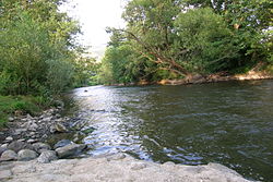 Studenica river near Ušće | |
| Location | |
| Country | Serbia |
| Physical characteristics | |
| Source | |
| - location | Golija mountain, Serbia (as the Crna reka) |
| - elevation | 1,615 m (5,299 ft) |
| Mouth | |
- location | Ibar, at Ušće, Serbia |
- coordinates | 43°28′09″N 20°37′09″E / 43.4692°N 20.6192°E / 43.4692; 20.6192Coordinates: 43°28′09″N 20°37′09″E / 43.4692°N 20.6192°E / 43.4692; 20.6192 |
| Length | 60 km (37 mi)[1] |
| Basin size | 582 km2 (225 sq mi) |
| Basin features | |
| Progression | Ibar→ West Morava→ Great Morava→ Danube→ Black Sea |
The Studenica (Serbian: Студеница, pronounced [studɛ̌nitsa]) is a river in southwestern Serbia, a 60 km-long left tributary to the Ibar river.[1]
Contents
1 Origin
2 Valley
3 Controversy
4 See also
5 References
Origin
The Studenica originates from the central section of the northern slopes of the Golija mountain, as the Crna reka (Black river), at an altitude of 1,615 m. The river flows northward, parallel to the flow of the Brusnička reka, next to the villages of Crna Reka, Koritnik, Ratari and Pločnik. Between the villages of Devič and Čečina, the Crna Reka and Brusnička reka meet and continue to the north under the name of Studenica.
Valley
The Studenica carved a long and deep gorge-like valley, characterized by the arc-shaped stretching in the west–east direction, between the Radočelo (on the south) and Čemerno (on the north) mountains. The villages of Usilje, Pridvorica, Mizdraci, Mlanča and Miliće are located in the valley, so as the Isposnica Monastery and the cave on Čemerno mountain.
But the most important feature in the entire Studenica valley is man-made: the Studenica Monastery, one of the oldest, largest and most famous of all Serbian Orthodox Church monasteries (UNESCO inscribed Studenica Monastery on the List of World Heritage Sites in 1986). Monastery is located near the village of the same name and after the village of Kosurići, the Studenica curves to the north emptying into the Ibar at the small town of Ušće.
The Studenica belongs to the Black Sea drainage basin, drains an area of 582 km² itself, and it is not navigable.
The name of the river, Studenica, in Serbian means cold water.
Controversy
In the valley, the river has a huge hydro electrical potential, but none is used so far. In the late 1980s and early 1990s government strongly pushed a project of damming the river and building a powerful hydro electrical power plant with the artificial lake. After the public outcry and protests from the Serbian Orthodox Church that the artificial lake would damage the monastery the idea was finally dropped.
See also
- Rivers in Serbia
References
^ ab Statistical Yearbook of the Republic of Serbia 2017 (PDF) (in Serbian and English). Belgrade: Statistical Office of the Republic of Serbia. October 2017. p. 16. ISSN 0354-4206. Retrieved 30 May 2018..mw-parser-output cite.citation{font-style:inherit}.mw-parser-output .citation q{quotes:"""""""'""'"}.mw-parser-output .citation .cs1-lock-free a{background:url("//upload.wikimedia.org/wikipedia/commons/thumb/6/65/Lock-green.svg/9px-Lock-green.svg.png")no-repeat;background-position:right .1em center}.mw-parser-output .citation .cs1-lock-limited a,.mw-parser-output .citation .cs1-lock-registration a{background:url("//upload.wikimedia.org/wikipedia/commons/thumb/d/d6/Lock-gray-alt-2.svg/9px-Lock-gray-alt-2.svg.png")no-repeat;background-position:right .1em center}.mw-parser-output .citation .cs1-lock-subscription a{background:url("//upload.wikimedia.org/wikipedia/commons/thumb/a/aa/Lock-red-alt-2.svg/9px-Lock-red-alt-2.svg.png")no-repeat;background-position:right .1em center}.mw-parser-output .cs1-subscription,.mw-parser-output .cs1-registration{color:#555}.mw-parser-output .cs1-subscription span,.mw-parser-output .cs1-registration span{border-bottom:1px dotted;cursor:help}.mw-parser-output .cs1-ws-icon a{background:url("//upload.wikimedia.org/wikipedia/commons/thumb/4/4c/Wikisource-logo.svg/12px-Wikisource-logo.svg.png")no-repeat;background-position:right .1em center}.mw-parser-output code.cs1-code{color:inherit;background:inherit;border:inherit;padding:inherit}.mw-parser-output .cs1-hidden-error{display:none;font-size:100%}.mw-parser-output .cs1-visible-error{font-size:100%}.mw-parser-output .cs1-maint{display:none;color:#33aa33;margin-left:0.3em}.mw-parser-output .cs1-subscription,.mw-parser-output .cs1-registration,.mw-parser-output .cs1-format{font-size:95%}.mw-parser-output .cs1-kern-left,.mw-parser-output .cs1-kern-wl-left{padding-left:0.2em}.mw-parser-output .cs1-kern-right,.mw-parser-output .cs1-kern-wl-right{padding-right:0.2em}
Mala Prosvetina Enciklopedija, Third edition (1985); Prosveta;
ISBN 86-07-00001-2
- Jovan Đ. Marković (1990): Enciklopedijski geografski leksikon Jugoslavije; Svjetlost-Sarajevo;
ISBN 86-01-02651-6


