Międzychód
This article may be expanded with text translated from the corresponding article in Polish. (February 2009) Click [show] for important translation instructions.
|
Międzychód | ||
|---|---|---|
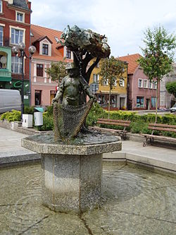
 Market Square | ||
| ||
 Międzychód | ||
| Coordinates: 52°36′N 15°53′E / 52.600°N 15.883°E / 52.600; 15.883 | ||
| Country | ||
| Voivodeship | Greater Poland | |
| County | Międzychód County | |
| Gmina | Gmina Międzychód | |
| Area | ||
| • Total | 6.98 km2 (2.69 sq mi) | |
| Population (2006) | ||
| • Total | 10,920 | |
| • Density | 1,600/km2 (4,100/sq mi) | |
| Postal code | 64-400 | |
| Website | www.miedzychod.pl | |
Międzychód [mʲɛnˈd͡zɨxut] (German: Birnbaum) is a town in Greater Poland Voivodeship, Poland, the administrative seat of Międzychód County. It is located on the southern shore of the Warta river, about 75 km (47 mi) west of Poznań. Population is 10,915 (2009).
Contents
1 History
2 Notable people
3 References
4 External links
History
The town was first mentioned as Międzybrud (after Polish bród, "ford") in a 1378 deed. Located in the western Poznań Voivodeship of the Greater Poland region, it was a settlement area for German artisans and merchants moving into the Polish lands from the adjacent Neumark region. In the course of the 1793 Second Partition of Poland, Birnbaum together with Greater Poland was annexed by the Kingdom of Prussia. From 1815 it was incorporated as the capital of the Kreis Birnbaum in the Regierungsbezirk of Posen, part of the Prussian Grand Duchy of Posen.
Upon the German defeat in World War I, the area was ceded to the newly established Second Polish Republic according to the 1919 Treaty of Versailles, with Międzychód as the westernmost town in Poland, close to the border with the Prussian Posen-West Prussia province. Again annexed by Nazi Germany and incorporated into the Reichsgau Wartheland upon the 1939 Invasion of Poland, it returned to Poland after World War II, while the German population was expelled. In recent years the town's economy increasingly has relied as a resort for tourism on the surrounding lakes of the Warta valley.
Notable people
Manuel Joël (1826–1890), rabbi and philosopher
Hermann Tietz (1834–?), rabbi
Hermann Tietz(1837–1907), merchant ("Hertie" department stores)
Leonhard Tietz (1849–1914), his nephew, merchant ("Kaufhof")
Oscar Tietz (1858–1923), his brother, merchant
Lesser Ury (1861–1931), Impressionist painter
Carl Hermann Busse (1872–1918), German lyric poet
References
External links
| Wikimedia Commons has media related to Międzychód. |
- Official town website
Coordinates: 52°36′N 15°54′E / 52.600°N 15.900°E / 52.600; 15.900


