Red River Delta
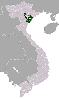
Location of the Red River Delta region in Vietnam
The Red River Delta (Vietnamese: Đồng Bằng Sông Hồng, or Châu Thổ Sông Hồng) is the flat low-lying plain formed by the Red River and its distributaries merging with the Thái Binh River in northern Vietnam. The delta has the smallest area but highest population and population density of all regions. The region measuring some 15,000 square km is well protected by a network of dikes. It is an agriculturally rich area and densely populated. Most of the land is devoted to rice cultivation.[1]
Eight provinces together with two municipalities, the capital Hanoi and the port Haiphong form the delta. It has a population of almost 19 million.
The Red River Delta is the cradle of the Vietnamese nation. Water puppetry originated in the rice paddies here.
The region was bombed by United States warplanes during the Vietnam War.
The region was designated as the Red River Delta Biosphere Reserve as part of UNESCO's Man and the Biosphere Programme in 2004.[2]
Contents
1 Provinces
2 Geography
3 Delta economy
4 See also
5 Notes and references
Provinces
| Province- Level Division | Capital | Population (2011)[3] | Area (km²) | Population density (/km²)[3] |
|---|---|---|---|---|
Bắc Ninh | Bắc Ninh | 1,060,300 | 823.1 km² | 1,289 |
Hà Nam | Phủ Lý | 786,900 | 859.7 km² | 914 |
Hải Dương | Hải Dương | 1,718,900 | 1,652.8 km² | 1,038 |
Hưng Yên | Hưng Yên | 1,150,400 | 923.5 km² | 1,242 |
Nam Định | Nam Định | 1,833,500 | 1,650.8 km² | 1,110 |
Ninh Bình | Ninh Bình | 906,900 | 1,392.4 km² | 652 |
Thái Bình | Thái Bình | 1,786,000 | 1,546.5 km² | 1,138 |
Vĩnh Phúc | Vĩnh Yên | 1,014,600 | 1,373.2 km² | 821 |
Hanoi (municipality) | 6,699,600 | 3328.9 km² | 2,013 | |
Haiphong (municipality) | 1,878,500 | 1,520.7 km² | 1,233 | |
| Total | 18,835,600 | 14,965.7 km² | 1,258 | |
Quảng Ninh Province is sometimes included as a province of the Red River Delta. Alternatively, it is seen as part of the Northeast region.
Hà Tây Province was merged into Hanoi in 2008.[4]
Geography
Spanning some 150 km in width, the Red River Delta is located in the western coastal zone of the Gulf of Tonkin. The Red River is the second largest river in Vietnam and one of the five largest rivers on the East Asia coast. Its catchment covers parts of China and Vietnam and its water and sediment discharges greatly influence the hydrology in the Gulf of Tonkin.
Delta economy
By the rich natural resources and favorable natural conditions, the delta has become an area of active economic development and high population density. In 2003, of the 78 million people in Vietnam, almost a third (24 million) live in the Red River basin, including over 17 million people in the delta itself. There are many large industrial zones in the Red River delta clustering in Viet Tri, Hanoi, Haiphong and Nam Dinh.
Agriculturally the Red River Delta is the second most important rice-producing area in Vietnam, accounting for 20% of the national crop. Additionally the delta region hosts other important economic activities such as fisheries, aquaculture, land reclamation for agriculture, harbor construction, mangrove forestry, etc. With these developmental pressures the estuarine environment and ecosystem face degradation due to threats of pollution, over-fishing and aquaculture destroying natural habitats. The socio-economic development in the delta is also affected by seasonal storms, flooding, coastal erosion, silting, salt water intrusion, etc.
See: Tran Duc Thanh, 2003. Researches in estuarine environment and ecosystem of red river: An overview on activities and results. Marine Resources and Environment. T.X: 34-53. Publishing House Science and Technology.Hanoi.[5]
See also
- Red River Delta coalfield
Notes and references
^ Whitfield, D. Historical and Cultural Dictionary of Vietnam. Metuchen, New Jersey: The Scarecrow Press, 1976
^ "Red River Delta | United Nations Educational, Scientific and Cultural Organization". www.unesco.org. Retrieved 2016-06-27..mw-parser-output cite.citation{font-style:inherit}.mw-parser-output .citation q{quotes:"""""""'""'"}.mw-parser-output .citation .cs1-lock-free a{background:url("//upload.wikimedia.org/wikipedia/commons/thumb/6/65/Lock-green.svg/9px-Lock-green.svg.png")no-repeat;background-position:right .1em center}.mw-parser-output .citation .cs1-lock-limited a,.mw-parser-output .citation .cs1-lock-registration a{background:url("//upload.wikimedia.org/wikipedia/commons/thumb/d/d6/Lock-gray-alt-2.svg/9px-Lock-gray-alt-2.svg.png")no-repeat;background-position:right .1em center}.mw-parser-output .citation .cs1-lock-subscription a{background:url("//upload.wikimedia.org/wikipedia/commons/thumb/a/aa/Lock-red-alt-2.svg/9px-Lock-red-alt-2.svg.png")no-repeat;background-position:right .1em center}.mw-parser-output .cs1-subscription,.mw-parser-output .cs1-registration{color:#555}.mw-parser-output .cs1-subscription span,.mw-parser-output .cs1-registration span{border-bottom:1px dotted;cursor:help}.mw-parser-output .cs1-ws-icon a{background:url("//upload.wikimedia.org/wikipedia/commons/thumb/4/4c/Wikisource-logo.svg/12px-Wikisource-logo.svg.png")no-repeat;background-position:right .1em center}.mw-parser-output code.cs1-code{color:inherit;background:inherit;border:inherit;padding:inherit}.mw-parser-output .cs1-hidden-error{display:none;font-size:100%}.mw-parser-output .cs1-visible-error{font-size:100%}.mw-parser-output .cs1-maint{display:none;color:#33aa33;margin-left:0.3em}.mw-parser-output .cs1-subscription,.mw-parser-output .cs1-registration,.mw-parser-output .cs1-format{font-size:95%}.mw-parser-output .cs1-kern-left,.mw-parser-output .cs1-kern-wl-left{padding-left:0.2em}.mw-parser-output .cs1-kern-right,.mw-parser-output .cs1-kern-wl-right{padding-right:0.2em}
^ ab General Statistics Office (2012): Statistical Yearbook of Vietnam 2011. Statistical Publishing House, Hanoi
^ VnExpress - Địa giới Hà Nội chính thức mở rộng từ 1/8 - Dia gioi Ha Noi chinh thuc mo rong tu 1/8
^ Thanh, Tran (1 January 2003). "Researches in estuarine environment and ecosystem of Red River: An overview on activities and results". MarINE Environment and Resources. Science and Technics Publishing. House. 10: 34–53 – via ResearchGate.
- http://www.academia.edu/7225727/Towards_an_environmental_history_of_the_eastern_Red_River_Delta_Vietnam_c.900-1400
Districts of the Red River Delta | ||
|---|---|---|
Hanoi city※ |
|  |
Haiphong city※ |
| |
| Bắc Ninh Province |
| |
| Hà Nam Province |
| |
| Hải Dương Province |
| |
| Hưng Yên Province |
| |
| Nam Định Province |
| |
| Ninh Bình Province |
| |
| Thái Bình Province |
| |
| Vĩnh Phúc Province |
| |
※ denotes provincial seat. | ||
Coordinates: 21°02′N 105°51′E / 21.033°N 105.850°E / 21.033; 105.850


