Williamstown, Kentucky
Williamstown, Kentucky | |
|---|---|
City | |
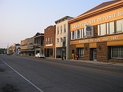 Main Street in Williamstown | |
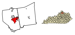 Location of Williamstown in Grant County, Kentucky. | |
| Coordinates: 38°38′28″N 84°33′39″W / 38.64111°N 84.56083°W / 38.64111; -84.56083Coordinates: 38°38′28″N 84°33′39″W / 38.64111°N 84.56083°W / 38.64111; -84.56083 | |
| Country | United States |
| State | Kentucky |
| Counties | Grant, Pendleton[1] |
| Area | |
| • Total | 16.9 sq mi (43.9 km2) |
| • Land | 16.4 sq mi (42.6 km2) |
| • Water | 0.5 sq mi (1.4 km2) |
| Elevation | 971 ft (296 m) |
| Population (2010) | |
| • Total | 3,925 |
| • Estimate (2016)[2] | 3,965 |
| • Density | 239/sq mi (92.2/km2) |
| Time zone | UTC-5 (Eastern (EST)) |
| • Summer (DST) | UTC-4 (EDT) |
| ZIP code | 41097 |
| Area code(s) | 859 |
| FIPS code | 21-83406 |
GNIS feature ID | 0506837 |
| Website | wtownky.org |
Williamstown is a home-rule-class city in Grant and Pendleton counties in the U.S. state of Kentucky. The population was 3,925 at the 2010 census,[3] up from 3,227 as of the 2000 census. It is the county seat of Grant County.[4]
Contents
1 History
2 Geography
2.1 Climate
3 Demographics
4 Notable people
5 Local attractions
6 References
7 External links
History
When Grant County was formed in 1820, William Arnold offered land for the county seat. Arnold was a veteran of the Revolutionary War and settled in the area in 1795. The town built there was named after him when it incorporated in 1825.[5]
The county grew slowly, reaching a population of just 281 by 1870. The Cincinnati Southern Railway was built through the county in 1877, and Williamstown Lake was created in 1957. Finally, Interstate 75 was built in the 1960s.
Geography
Williamstown is located east of the center of Grant County at 38°38′28″N 84°33′39″W / 38.64111°N 84.56083°W / 38.64111; -84.56083 (38.641184, -84.560920).[6] It is bordered to the north by the city of Dry Ridge. The city limits extend northeast 5 miles (8 km) along Falmouth Road and East Fairview Road to slightly enter Pendleton County. Interstate 75 passes through the west side of the city, with access from Exits 154 and 156. I-75 leads north 37 miles (60 km) to Cincinnati and south 45 miles (72 km) to Lexington. U.S. Route 25 passes through the center of Williamstown as Main Street; US 25 leads north 11 miles (18 km) to Crittenden and south the same distance to Corinth.
According to the United States Census Bureau, Williamstown has a total area of 16.9 square miles (43.9 km2), of which 16.4 square miles (42.6 km2) is land and 0.54 square miles (1.4 km2), or 3.13%, is water.[3]Williamstown Lake, a reservoir on the South Fork of Grassy Creek, is in the northeast part of the city.
Climate
The climate in this area is characterized by hot, humid summers and generally mild to cool winters. According to the Köppen Climate Classification system, Williamstown has a humid subtropical climate, abbreviated "Cfa" on climate maps.[7]
Demographics
| Historical population | |||
|---|---|---|---|
| Census | Pop. | %± | |
| 1830 | 197 | — | |
| 1850 | 317 | — | |
| 1860 | 256 | −19.2% | |
| 1870 | 281 | 9.8% | |
| 1880 | 751 | 167.3% | |
| 1890 | 573 | −23.7% | |
| 1900 | 613 | 7.0% | |
| 1910 | 800 | 30.5% | |
| 1920 | 836 | 4.5% | |
| 1930 | 917 | 9.7% | |
| 1940 | 1,077 | 17.4% | |
| 1950 | 1,466 | 36.1% | |
| 1960 | 1,611 | 9.9% | |
| 1970 | 2,063 | 28.1% | |
| 1980 | 2,502 | 21.3% | |
| 1990 | 3,023 | 20.8% | |
| 2000 | 3,227 | 6.7% | |
| 2010 | 3,925 | 21.6% | |
| Est. 2016 | 3,965 | [2] | 1.0% |
| U.S. Decennial Census[8] | |||
As of the census[9] of 2010, there were 3,925 people, 1,279 households, and 879 families residing in the city. The population density was 202.2 people per square mile (78.1/km²). There were 1,375 housing units at an average density of 86.2 per square mile (33.3/km²). The racial makeup of the city was 95.72% White, 1.78% African American, 0.25% Native American, 0.18% Asian, 0.36% Pacific Islander, 0.99% from other races, and 0.71% from two or more races. Hispanic or Latino of any race were 1.46% of the population.
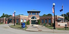
Williamstown Municipal Building
There were 1,279 households out of which 32.0% had children under the age of 18 living with them, 52.3% were married couples living together, 13.1% had a female householder with no husband present, and 31.2% were non-families. 28.4% of all households were made up of individuals and 15.9% had someone living alone who was 65 years of age or older. The average household size was 2.45 and the average family size was 2.98.
In the city, the population was spread out with 25.8% under the age of 18, 8.5% from 18 to 24, 28.6% from 25 to 44, 20.4% from 45 to 64, and 16.6% who were 65 years of age or older. The median age was 35 years. For every 100 females, there were 85.5 males. For every 100 females age 18 and over, there were 82.3 males.
The median income for a household in the city was $33,750, and the median income for a family was $44,808. Males had a median income of $31,466 versus $21,492 for females. The per capita income for the city was $17,945. About 10.9% of families and 15.4% of the population were below the poverty line, including 16.1% of those under age 18 and 20.1% of those age 65 or over.
Notable people
Rodney McMullen, CEO of Kroger
Arnie Risen, basketball player, nominated to Basketball Hall of Fame
Doc Sechrist, baseball player
Harry Westover, United States federal judge
Local attractions
Ark Encounter, Christian theme park with a full-scale interpretation of Noah's Ark, operated by Answers in Genesis
References
^ "Subcounty population estimates: Kentucky 2000-2007" (CSV). United States Census Bureau, Population Division. 2009-03-18. Retrieved 2009-04-04..mw-parser-output cite.citation{font-style:inherit}.mw-parser-output q{quotes:"""""""'""'"}.mw-parser-output code.cs1-code{color:inherit;background:inherit;border:inherit;padding:inherit}.mw-parser-output .cs1-lock-free a{background:url("//upload.wikimedia.org/wikipedia/commons/thumb/6/65/Lock-green.svg/9px-Lock-green.svg.png")no-repeat;background-position:right .1em center}.mw-parser-output .cs1-lock-limited a,.mw-parser-output .cs1-lock-registration a{background:url("//upload.wikimedia.org/wikipedia/commons/thumb/d/d6/Lock-gray-alt-2.svg/9px-Lock-gray-alt-2.svg.png")no-repeat;background-position:right .1em center}.mw-parser-output .cs1-lock-subscription a{background:url("//upload.wikimedia.org/wikipedia/commons/thumb/a/aa/Lock-red-alt-2.svg/9px-Lock-red-alt-2.svg.png")no-repeat;background-position:right .1em center}.mw-parser-output .cs1-subscription,.mw-parser-output .cs1-registration{color:#555}.mw-parser-output .cs1-subscription span,.mw-parser-output .cs1-registration span{border-bottom:1px dotted;cursor:help}.mw-parser-output .cs1-hidden-error{display:none;font-size:100%}.mw-parser-output .cs1-visible-error{font-size:100%}.mw-parser-output .cs1-subscription,.mw-parser-output .cs1-registration,.mw-parser-output .cs1-format{font-size:95%}.mw-parser-output .cs1-kern-left,.mw-parser-output .cs1-kern-wl-left{padding-left:0.2em}.mw-parser-output .cs1-kern-right,.mw-parser-output .cs1-kern-wl-right{padding-right:0.2em}
^ ab "Population and Housing Unit Estimates". Retrieved June 9, 2017.
^ ab "Geographic Identifiers: 2010 Demographic Profile Data (G001): Williamstown city, Kentucky". American Factfinder. U.S. Census Bureau. Retrieved December 8, 2016.
^ "Find a County". National Association of Counties. Retrieved 2011-06-07.
^ Collins, Lewis (1877). History of Kentucky. p. 290.
^ "US Gazetteer files: 2010, 2000, and 1990". United States Census Bureau. 2011-02-12. Retrieved 2011-04-23.
^ Climate Summary for Williamstown, Kentucky
^ "Census of Population and Housing". Census.gov. Retrieved June 4, 2015.
^ "American FactFinder". United States Census Bureau. Retrieved 2008-01-31.
External links
- City of Williamstown official website
- Historical Texts and Images of Williamstown
Municipalities and communities of Grant County, Kentucky, United States | ||
|---|---|---|
County seat: Williamstown | ||
| Cities |
|  |
| Unincorporated communities |
| |
| Footnotes | ‡This populated place also has portions in an adjacent county or counties | |
Municipalities and communities of Pendleton County, Kentucky, United States | ||
|---|---|---|
County seat: Falmouth | ||
| Cities |
|  |
| Unincorporated communities |
| |
| Footnotes | ‡This populated place also has portions in an adjacent county or counties | |


