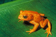
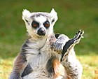
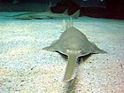
Critically endangered
Conservation status by IUCN Red List category | |
|---|---|
 | |
| Extinct | |
|
|
| Threatened | |
|
|
| Lower Risk | |
|
|
Other categories | |
|
|
Related topics
| |
  | |
A critically endangered (CR) species is one that has been categorized by the International Union for Conservation of Nature (IUCN) as facing an extremely high risk of extinction in the wild.[1]
As of 2014, there are 2464 animal and 2104 plant species with this assessment, compared with 1998 levels of 854 and 909, respectively.[2]
As the IUCN Red List does not consider a species extinct until extensive, targeted surveys have been conducted, species that are possibly extinct are still listed as critically endangered. IUCN maintains a list[3] of "possibly extinct" CR(PE) and "possibly extinct in the wild" CR(PEW) species, modelled on categories used by BirdLife International to categorize these taxa.
Contents
1 International Union for Conservation of Nature definition
2 See also
3 Notes
4 References
5 External links
International Union for Conservation of Nature definition
To be defined as critically endangered in the Red List, a species must meet any of the following criteria (A–E) ("3G/10Y" signifies three generations or ten years—whichever is longer—over a maximum of 100 years; "MI" signifies Mature Individuals):[4]
A: Occurring over less than 100 km² and two of:
- 1. Severe habitat fragmentation or existing at just one location
- 2. Decline in extent of occurrence, area of occupancy, area/extent/quality of habitat, number of locations/subpopulations, or amount of MI.
- 3. Extreme fluctuations in extent of occurrence, area of occupancy, number of locations/subpopulations, or amount of MI.
B: As above, but less than 10 km² (used to show differing levels of severity).
C: Declining population of less than 250 MI and either:
- 1. A decline of 25% over 3G/10Y;
- 2. Extreme fluctuations, or over 90% of MI in a single subpopulation, or no more than 50 MI in any one subpopulation.
D: Numbers less than 50 MI.
E: At least 50% chance of going Extinct in the Wild over 3G/10Y.
See also
Lists of IUCN Red List Critically Endangered species for lists ordered by taxonomic rank.
Category:IUCN Red List critically endangered species for an alphabetical list- The World's 25 Most Endangered Primates
- The world's 100 most threatened species
IUCN for additional information on the IUCN- List of critically endangered amphibians
- List of critically endangered arthropods
- List of critically endangered birds
- List of critically endangered fish
- List of critically endangered insects
- List of critically endangered invertebrates
- List of critically endangered mammals
- List of critically endangered molluscs
- List of critically endangered plants
- List of critically endangered reptiles
- List of Chromista by conservation status
- List of fungi by conservation status
Notes
^ "IUCN RED LIST CATEGORIES AND CRITERIA" (PDF). 2000-02-09. Retrieved 2018-02-06..mw-parser-output cite.citation{font-style:inherit}.mw-parser-output q{quotes:"""""""'""'"}.mw-parser-output code.cs1-code{color:inherit;background:inherit;border:inherit;padding:inherit}.mw-parser-output .cs1-lock-free a{background:url("//upload.wikimedia.org/wikipedia/commons/thumb/6/65/Lock-green.svg/9px-Lock-green.svg.png")no-repeat;background-position:right .1em center}.mw-parser-output .cs1-lock-limited a,.mw-parser-output .cs1-lock-registration a{background:url("//upload.wikimedia.org/wikipedia/commons/thumb/d/d6/Lock-gray-alt-2.svg/9px-Lock-gray-alt-2.svg.png")no-repeat;background-position:right .1em center}.mw-parser-output .cs1-lock-subscription a{background:url("//upload.wikimedia.org/wikipedia/commons/thumb/a/aa/Lock-red-alt-2.svg/9px-Lock-red-alt-2.svg.png")no-repeat;background-position:right .1em center}.mw-parser-output .cs1-subscription,.mw-parser-output .cs1-registration{color:#555}.mw-parser-output .cs1-subscription span,.mw-parser-output .cs1-registration span{border-bottom:1px dotted;cursor:help}.mw-parser-output .cs1-hidden-error{display:none;font-size:100%}.mw-parser-output .cs1-visible-error{font-size:100%}.mw-parser-output .cs1-subscription,.mw-parser-output .cs1-registration,.mw-parser-output .cs1-format{font-size:95%}.mw-parser-output .cs1-kern-left,.mw-parser-output .cs1-kern-wl-left{padding-left:0.2em}.mw-parser-output .cs1-kern-right,.mw-parser-output .cs1-kern-wl-right{padding-right:0.2em}
^ IUCN (2014). "Table 2: Changes in numbers of species in the threatened categories (CR, EN, VU) from 1996 to 2014 (IUCN Red List version 2014.2) for the major taxonomic groups on the Red List" (PDF). Retrieved 2014-08-30.
^ "Summary Statistics". www.iucnredlist.org. Retrieved 2017-12-10.
^ IUCN (9 Feb 2000). "IUCN Red List Categories and Criteria, Version 3.1" (PDF). Retrieved 2012-12-31.
References
List of Critically Endangered Species. IUCN Red List of Threatened Species. Version 2014.2. International Union for Conservation of Nature. 2014. Retrieved 30 August 2014.
External links
The Criteria for Critically Endangered, IUCN
Threatened species | ||||||||||||||||||||
|---|---|---|---|---|---|---|---|---|---|---|---|---|---|---|---|---|---|---|---|---|
Template: Threatened species by region | ||||||||||||||||||||
IUCN Red List |
|  | ||||||||||||||||||
| By taxa |
| |||||||||||||||||||
| Conservation |
| |||||||||||||||||||
1 Pre-2001 categories and subcategories shown in italics. | ||||||||||||||||||||
Threatened species by region | |||||||||
|---|---|---|---|---|---|---|---|---|---|
| By region |
|   | |||||||
| Australasia |
| ||||||||
| Canada |
| ||||||||
| Europe |
| ||||||||
| South Africa |
| ||||||||
| United States |
| ||||||||
| Lists |
| ||||||||


