Granville, Illinois
Village of Granville | |
|---|---|
 Downtown Granville, Illinois | |
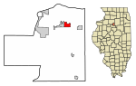 Location of Granville in Putnam County, Illinois. | |
| Coordinates: 41°15′45″N 89°13′41″W / 41.26250°N 89.22806°W / 41.26250; -89.22806Coordinates: 41°15′45″N 89°13′41″W / 41.26250°N 89.22806°W / 41.26250; -89.22806 | |
| Country | United States |
| State | Illinois |
| County | Putnam |
| Township | Granville |
| Area [1] | |
| • Total | 0.97 sq mi (2.51 km2) |
| • Land | 0.97 sq mi (2.51 km2) |
| • Water | 0.00 sq mi (0.00 km2) 0% |
| Elevation | 683 ft (208 m) |
| Population (2010) | |
| • Total | 1,427 |
| • Estimate (2016)[2] | 1,305 |
| • Density | 1,346.75/sq mi (520.06/km2) |
| Time zone | UTC-6 (CST) |
| • Summer (DST) | UTC-5 (CDT) |
| ZIP codes | 61326 |
| FIPS code | 17-31017 |
| Website | http://villageofgranville.org/ |
Granville is a village in Putnam County, Illinois, United States. The population was 1,427 at the 2010 census, up from 1,414 in 2000, making it the largest community in Putnam County. It is part of the Ottawa–Streator Micropolitan Statistical Area.
Contents
1 History
2 Geography
3 Demographics
4 Notable people
5 References
History
The village of Granville is named after Granville, Massachusetts.[3]
On April 20, 2004, Granville was struck by a series of tornadoes, which destroyed the local primary school, the high school baseball diamond, and numerous houses.
Geography
Granville is located at 41°15′45″N 89°13′41″W / 41.26250°N 89.22806°W / 41.26250; -89.22806 (41.262480, -89.227949).[4]
According to the 2010 census, the village has a total area of 0.97 square miles (2.5 km2), all land.[5]
Demographics
| Historical population | |||
|---|---|---|---|
| Census | Pop. | %± | |
| 1880 | 260 | — | |
| 1890 | 148 | −43.1% | |
| 1900 | 320 | 116.2% | |
| 1910 | 1,391 | 334.7% | |
| 1920 | 1,427 | 2.6% | |
| 1930 | 949 | −33.5% | |
| 1940 | 1,038 | 9.4% | |
| 1950 | 978 | −5.8% | |
| 1960 | 1,048 | 7.2% | |
| 1970 | 1,232 | 17.6% | |
| 1980 | 1,537 | 24.8% | |
| 1990 | 1,407 | −8.5% | |
| 2000 | 1,414 | 0.5% | |
| 2010 | 1,427 | 0.9% | |
| Est. 2016 | 1,305 | [2] | −8.5% |
| U.S. Decennial Census[6] | |||
As of the census[7] of 2000, there were 1,414 people, 591 households, and 395 families residing in the village. The population density was 1,476.8 people per square mile (568.7/km²). There were 626 housing units at an average density of 653.8 per square mile (251.8/km²). The racial makeup of the village was 97.88% White, 0.42% African American, 0.07% Native American, 0.42% Asian, 0.71% from other races, and 0.50% from two or more races. Hispanic or Latino of any race were 3.39% of the population.
There were 591 households out of which 29.8% had children under the age of 18 living with them, 54.8% were married couples living together, 8.1% had a female householder with no husband present, and 33.0% were non-families. 30.5% of all households were made up of individuals and 17.3% had someone living alone who was 65 years of age or older. The average household size was 2.39 and the average family size was 2.95.
In the village, the population was spread out with 24.8% under the age of 18, 7.6% from 18 to 24, 24.7% from 25 to 44, 25.8% from 45 to 64, and 17.0% who were 65 years of age or older. The median age was 40 years. For every 100 females, there were 86.1 males. For every 100 females age 18 and over, there were 84.2 males.
The median income for a household in the village was $41,548, and the median income for a family was $55,093. Males had a median income of $41,932 versus $21,364 for females. The per capita income for the village was $20,074. About 3.6% of families and 4.1% of the population were below the poverty line, including 5.5% of those under age 18 and 6.2% of those age 65 or over.
Notable people
Edward K. Hall, former University of Illinois football coach
Red Ruffing, Hall-of-Fame pitcher for the Boston Red Sox, New York Yankees, and Chicago White Sox; born in Granville
References
| Wikimedia Commons has media related to Granville, Illinois. |
^ "2016 U.S. Gazetteer Files". United States Census Bureau. Retrieved Jun 29, 2017..mw-parser-output cite.citation{font-style:inherit}.mw-parser-output .citation q{quotes:"""""""'""'"}.mw-parser-output .citation .cs1-lock-free a{background:url("//upload.wikimedia.org/wikipedia/commons/thumb/6/65/Lock-green.svg/9px-Lock-green.svg.png")no-repeat;background-position:right .1em center}.mw-parser-output .citation .cs1-lock-limited a,.mw-parser-output .citation .cs1-lock-registration a{background:url("//upload.wikimedia.org/wikipedia/commons/thumb/d/d6/Lock-gray-alt-2.svg/9px-Lock-gray-alt-2.svg.png")no-repeat;background-position:right .1em center}.mw-parser-output .citation .cs1-lock-subscription a{background:url("//upload.wikimedia.org/wikipedia/commons/thumb/a/aa/Lock-red-alt-2.svg/9px-Lock-red-alt-2.svg.png")no-repeat;background-position:right .1em center}.mw-parser-output .cs1-subscription,.mw-parser-output .cs1-registration{color:#555}.mw-parser-output .cs1-subscription span,.mw-parser-output .cs1-registration span{border-bottom:1px dotted;cursor:help}.mw-parser-output .cs1-ws-icon a{background:url("//upload.wikimedia.org/wikipedia/commons/thumb/4/4c/Wikisource-logo.svg/12px-Wikisource-logo.svg.png")no-repeat;background-position:right .1em center}.mw-parser-output code.cs1-code{color:inherit;background:inherit;border:inherit;padding:inherit}.mw-parser-output .cs1-hidden-error{display:none;font-size:100%}.mw-parser-output .cs1-visible-error{font-size:100%}.mw-parser-output .cs1-maint{display:none;color:#33aa33;margin-left:0.3em}.mw-parser-output .cs1-subscription,.mw-parser-output .cs1-registration,.mw-parser-output .cs1-format{font-size:95%}.mw-parser-output .cs1-kern-left,.mw-parser-output .cs1-kern-wl-left{padding-left:0.2em}.mw-parser-output .cs1-kern-right,.mw-parser-output .cs1-kern-wl-right{padding-right:0.2em}
^ ab "Population and Housing Unit Estimates". Retrieved June 9, 2017.
^ Gannett, Henry (1905). The Origin of Certain Place Names in the United States. Govt. Print. Off. p. 142.
^ "US Gazetteer files: 2010, 2000, and 1990". United States Census Bureau. 2011-02-12. Retrieved 2011-04-23.
^ "2010 Census U.S. Gazetteer Files for Places – Illinois". United States Census. Archived from the original on 2013-01-12. Retrieved 2012-10-13.
^ "Census of Population and Housing". Census.gov. Archived from the original on May 12, 2015. Retrieved June 4, 2015.
^ "American FactFinder". United States Census Bureau. Archived from the original on 2013-09-11. Retrieved 2008-01-31.
Municipalities and communities of Putnam County, Illinois, United States | ||
|---|---|---|
County seat: Hennepin | ||
| Villages |
| |
| Townships |
| |
| Unincorporated communities |
| |
| Footnotes | ‡This populated place also has portions in an adjacent county or counties | |


