Hlotse
Hlotse | |
|---|---|
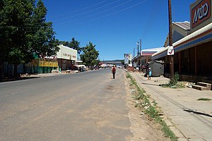 Downtown Hlotse | |
 Hlotse Location in Lesotho | |
| Coordinates: 28°52′24.1″S 28°02′29.7″E / 28.873361°S 28.041583°E / -28.873361; 28.041583 | |
| Country | |
| District | Leribe District |
| Population (2016) | |
| • Total | 38,558 |
| Time zone | UTC+2 (SAST) |
Hlotse (also Leribe) is an important market town in Lesotho. It is situated on the Hlotse River, near the South African border. The town was founded in 1876 by a British missionary, Reverend John Widdicombe. It was a colonial center until Lesotho gained its independence. The population in 2016 was 38,558.[1]
The alternate name, Leribe, comes from the adjacent French Protestant Leribe Mission, founded in 1859 by François Coillard. Hlotse is also called Leribe because it is the camptown in the district of Leribe.
The main Basotho Headquarters for Help Lesotho is in Hlotse.
Places of interest

Leribe Craft Center
Three different sightseeing locations are the Leribe Craft Center, statue in front of the District Administration office, and an old military lookout.
The Leribe Craft Center sells handmade wool items ranging from scarfs to jackets. The craft center is located on the side of the road as a person comes into Hlotse. The statue in front of the District Administration building dates back to English rule of Lesotho. It is located in the central part of the city. The old military lookout also dates back to English rule and is located in the central part of the city.
References
^ Lesotho Bureau of Statistics
External links
 Hlotse travel guide from Wikivoyage
Coordinates: 28°52′24.1″S 28°02′29.7″E / 28.873361°S 28.041583°E / -28.873361; 28.041583
|


