Fishing Creek Township, Columbia County, Pennsylvania
| Fishing Creek Township, Pennsylvania | |
|---|---|
| Township | |
 View of Fishing Creek Township in early winter | |
 Location of Fishing Creek Township in Columbia County | |
 Location of Columbia County in Pennsylvania | |
| Country | United States |
| State | Pennsylvania |
| County | Columbia |
| Settled | 1783 |
| Incorporated | 1789 |
| Area[1] | |
| • Total | 28.73 sq mi (74.41 km2) |
| • Land | 28.43 sq mi (73.63 km2) |
| • Water | 0.30 sq mi (0.79 km2) |
| Population (2010) | |
| • Total | 1,416 |
| • Estimate (2016)[2] | 1,411 |
| • Density | 49.64/sq mi (19.16/km2) |
| Time zone | UTC-5 (Eastern (EST)) |
| • Summer (DST) | UTC-4 (EDT) |
| Area code(s) | 570 |
| FIPS code | 42-037-26056 |
| Website | fishingcreektownship.org |
Fishing Creek Township is a township in Columbia County, Pennsylvania, United States. The population was 1,416 at the 2010 census.[3]
Contents
1 History
2 Geography
3 Demographics
4 References
5 External links
History
The Josiah Hess Covered Bridge No. 122, Twin Bridges-East Paden Covered Bridge No. 120, and Twin Bridges-West Paden Covered Bridge No. 121 were listed on the National Register of Historic Places in 1979. The Bridge in Fishing Creek Township was listed in 1988.[4]
Geography

Scenery of eastern Fishing Creek Township

Fishing Creek Township as seen from Winding Road
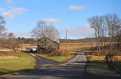
Fishing Creek Township is in northeastern Columbia County, bordered to the east by Luzerne County. The connected ridges of Huntington Mountain and Knob Mountain form the southern boundary. The township surrounds the borough of Stillwater, a separate municipality. The unincorporated communities of Honeytown, Van Camp, Bendertown, Zaner, Pealertown, Forks, Asbury, and Jonestown are in the township.
According to the United States Census Bureau, the township has a total area of 28.7 square miles (74.4 km2), of which 28.4 square miles (73.6 km2) is land and 0.3 square miles (0.8 km2), or 1.06%, is water.[3] Major streams in the township are Fishing Creek and Huntington Creek, its tributary. Fishing Creek flows south to the Susquehanna River at Bloomsburg.
Demographics
| Historical population | |||
|---|---|---|---|
| Census | Pop. | %± | |
| 2010 | 1,416 | — | |
| Est. 2016 | 1,411 | [2] | −0.4% |
| U.S. Decennial Census[5] | |||
As of the census[6] of 2000, there were 1,393 people, 556 households, and 425 families residing in the township. The population density was 48.8 people per square mile (18.9/km²). There were 711 housing units at an average density of 24.9/sq mi (9.6/km²). The racial makeup of the township was 99.21% White, 0.14% Asian, 0.14% from other races, and 0.50% from two or more races. Hispanic or Latino of any race were 0.79% of the population.
There were 556 households, out of which 29.0% had children under the age of 18 living with them, 66.4% were married couples living together, 7.0% had a female householder with no husband present, and 23.4% were non-families. 20.1% of all households were made up of individuals, and 8.5% had someone living alone who was 65 years of age or older. The average household size was 2.51 and the average family size was 2.88.
In the township the population was spread out, with 22.3% under the age of 18, 6.2% from 18 to 24, 29.4% from 25 to 44, 27.8% from 45 to 64, and 14.4% who were 65 years of age or older. The median age was 41 years. For every 100 females, there were 99.3 males. For every 100 females age 18 and over, there were 96.6 males.
The median income for a household in the township was $38,654, and the median income for a family was $44,118. Males had a median income of $30,114 versus $23,580 for females. The per capita income for the township was $18,121. About 6.6% of families and 7.5% of the population were below the poverty line, including 10.1% of those under age 18 and 10.4% of those age 65 or over.
References

One room schoolhouse
^ "2016 U.S. Gazetteer Files". United States Census Bureau. Retrieved Aug 13, 2017..mw-parser-output cite.citation{font-style:inherit}.mw-parser-output q{quotes:"""""""'""'"}.mw-parser-output code.cs1-code{color:inherit;background:inherit;border:inherit;padding:inherit}.mw-parser-output .cs1-lock-free a{background:url("//upload.wikimedia.org/wikipedia/commons/thumb/6/65/Lock-green.svg/9px-Lock-green.svg.png")no-repeat;background-position:right .1em center}.mw-parser-output .cs1-lock-limited a,.mw-parser-output .cs1-lock-registration a{background:url("//upload.wikimedia.org/wikipedia/commons/thumb/d/d6/Lock-gray-alt-2.svg/9px-Lock-gray-alt-2.svg.png")no-repeat;background-position:right .1em center}.mw-parser-output .cs1-lock-subscription a{background:url("//upload.wikimedia.org/wikipedia/commons/thumb/a/aa/Lock-red-alt-2.svg/9px-Lock-red-alt-2.svg.png")no-repeat;background-position:right .1em center}.mw-parser-output .cs1-subscription,.mw-parser-output .cs1-registration{color:#555}.mw-parser-output .cs1-subscription span,.mw-parser-output .cs1-registration span{border-bottom:1px dotted;cursor:help}.mw-parser-output .cs1-hidden-error{display:none;font-size:100%}.mw-parser-output .cs1-visible-error{font-size:100%}.mw-parser-output .cs1-subscription,.mw-parser-output .cs1-registration,.mw-parser-output .cs1-format{font-size:95%}.mw-parser-output .cs1-kern-left,.mw-parser-output .cs1-kern-wl-left{padding-left:0.2em}.mw-parser-output .cs1-kern-right,.mw-parser-output .cs1-kern-wl-right{padding-right:0.2em}
^ ab "Population and Housing Unit Estimates". Retrieved June 9, 2017.
^ ab "Geographic Identifiers: 2010 Census Summary File 1 (G001): Fishing Creek township, Columbia County, Pennsylvania". U.S. Census Bureau, American Factfinder. Retrieved May 21, 2015.
^ National Park Service (2010-07-09). "National Register Information System". National Register of Historic Places. National Park Service.
^ "Census of Population and Housing". Census.gov. Retrieved June 4, 2016.
^ "American FactFinder". United States Census Bureau. Archived from the original on September 11, 2013. Retrieved 2008-01-31.
External links
- Fishing Creek Township official website
Municipalities and communities of Columbia County, Pennsylvania, United States | ||
|---|---|---|
County seat: Bloomsburg | ||
| Town |
|  |
| Boroughs |
| |
| Townships |
| |
| CDPs |
| |
| Unincorporated communities |
| |
| Ghost Towns |
| |
| Footnotes | ‡This populated place also has portions in an adjacent county or counties | |
Coordinates: 41°08′00″N 76°22′59″W / 41.13333°N 76.38306°W / 41.13333; -76.38306


