Lexington Airport (Oregon)
Lexington Airport | |||||||||||
|---|---|---|---|---|---|---|---|---|---|---|---|
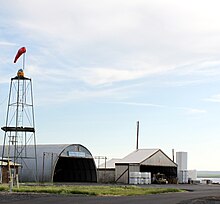 Hangars and windsock at Lexington Airport | |||||||||||
| |||||||||||
| Summary | |||||||||||
| Airport type | Public | ||||||||||
| Operator | Morrow County | ||||||||||
| Location | Lexington, Oregon | ||||||||||
| Elevation AMSL | 1,634 ft / 498 m | ||||||||||
| Coordinates | 45°27′14.9210″N 119°41′24.96″W / 45.454144722°N 119.6902667°W / 45.454144722; -119.6902667Coordinates: 45°27′14.9210″N 119°41′24.96″W / 45.454144722°N 119.6902667°W / 45.454144722; -119.6902667 | ||||||||||
Runways | |||||||||||
| |||||||||||
Lexington Airport (FAA LID: 9S9), is a public airport located one mile (1.6 km) north of Lexington in Morrow County, in the U.S. state of Oregon.
See also
- Boardman Airport
External links
- Morrow County Airport website
- Resources for this airport:
- FAA airport information for 9S9
- AirNav airport information for 9S9
- FlightAware airport information and live flight tracker
- SkyVector aeronautical chart for 9S9
- FAA airport information for 9S9
This article about an airport in Oregon is a stub. You can help Wikipedia by expanding it. |
This article about a building or structure in Oregon is a stub. You can help Wikipedia by expanding it. |


