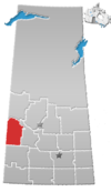
Tramping Lake, Saskatchewan
| Tramping Lake | |
|---|---|
| Village | |
 Location of Tramping Lake in Saskatchewan Show map of Saskatchewan  Tramping Lake, Saskatchewan (Canada) Show map of Canada | |
| Coordinates: 52°08′06″N 108°56′56″W / 52.135°N 108.949°W / 52.135; -108.949 | |
| Country | Canada |
| Province | Saskatchewan |
| Region | Saskatchewan |
| Census division | 13 |
| Rural Municipality | Mariposa |
| Post office Founded | N/A |
| Incorporated (Village) | N/A |
| Incorporated (Town) | N/A |
| Government | |
| • Mayor | Christine Lang |
| • Administrator | Rose Simon |
| • Governing body | Tramping Lake Village Council |
| Area | |
| • Total | 1.39 km2 (0.54 sq mi) |
| Population (2016) | |
| • Total | 60 |
| • Density | 43.2/km2 (112/sq mi) |
| Time zone | CST |
| Postal code | S0K 4H0 |
| Area code(s) | 306 |
| Highways | Highway 374 Highway 674 |
| Waterways | Tramping Lake |
[1][2][3][4] | |
Tramping Lake is a village in the Rural Municipality of Mariposa No. 350, Saskatchewan, Canada. The village gets its name from nearby Tramping Lake.
Contents
1 Demographics
2 See also
3 Footnotes
4 External links
Demographics
| Canada census – Tramping Lake, Saskatchewan community profile | |||
|---|---|---|---|
2016 | |||
| Population: | 60 (+ 9.1% from 2011) | ||
| Land area: | 1.39 km2 (0.54 sq mi) | ||
| Population density: | 43.2/km2 (112/sq mi) | ||
| Median age: | 48.5 (M: 52.8, F: 37.2) | ||
| Total private dwellings: | 44 | ||
| Median household income: | $NA | ||
| References: 2016[5] earlier[6] | |||
See also
- List of communities in Saskatchewan
- Villages of Saskatchewan
Footnotes
^ National Archives, Archivia Net, Post Offices and Postmasters.mw-parser-output cite.citation{font-style:inherit}.mw-parser-output q{quotes:"""""""'""'"}.mw-parser-output code.cs1-code{color:inherit;background:inherit;border:inherit;padding:inherit}.mw-parser-output .cs1-lock-free a{background:url("//upload.wikimedia.org/wikipedia/commons/thumb/6/65/Lock-green.svg/9px-Lock-green.svg.png")no-repeat;background-position:right .1em center}.mw-parser-output .cs1-lock-limited a,.mw-parser-output .cs1-lock-registration a{background:url("//upload.wikimedia.org/wikipedia/commons/thumb/d/d6/Lock-gray-alt-2.svg/9px-Lock-gray-alt-2.svg.png")no-repeat;background-position:right .1em center}.mw-parser-output .cs1-lock-subscription a{background:url("//upload.wikimedia.org/wikipedia/commons/thumb/a/aa/Lock-red-alt-2.svg/9px-Lock-red-alt-2.svg.png")no-repeat;background-position:right .1em center}.mw-parser-output .cs1-subscription,.mw-parser-output .cs1-registration{color:#555}.mw-parser-output .cs1-subscription span,.mw-parser-output .cs1-registration span{border-bottom:1px dotted;cursor:help}.mw-parser-output .cs1-hidden-error{display:none;font-size:100%}.mw-parser-output .cs1-visible-error{font-size:100%}.mw-parser-output .cs1-subscription,.mw-parser-output .cs1-registration,.mw-parser-output .cs1-format{font-size:95%}.mw-parser-output .cs1-kern-left,.mw-parser-output .cs1-kern-wl-left{padding-left:0.2em}.mw-parser-output .cs1-kern-right,.mw-parser-output .cs1-kern-wl-right{padding-right:0.2em}
^ Government of Saskatchewan, MRD Home, Municipal Directory System, archived from the original (– Scholar search) on November 21, 2008
^ Canadian Textiles Institute. (2005), CTI Determine your provincial constituency, archived from the original on 2007-09-11
^ Commissioner of Canada Elections, Chief Electoral Officer of Canada (2005), Elections Canada On-line
^ "2016 Community Profiles". Canada 2016 Census. Statistics Canada. February 21, 2017.
^ "2001 Community Profiles". Canada 2001 Census. Statistics Canada. February 17, 2012.
External links
- Saskatchewan City & Town Maps
- Saskatchewan Gen Web - One Room School Project
- Post Offices and Postmasters - ArchiviaNet - Library and Archives Canada
- Saskatchewan Gen Web Region
- Online Historical Map Digitization Project
- GeoNames Query
- 2006 Community Profiles
Coordinates: 52°08′06″N 108°56′56″W / 52.135°N 108.949°W / 52.135; -108.949
