Luseland
| Luseland | |
|---|---|
| Town | |
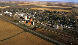 Aerial view of Luseland | |
 Luseland Location of Luseland in Saskatchewan | |
| Coordinates: 52°04′54.5″N 109°23′24.4″W / 52.081806°N 109.390111°W / 52.081806; -109.390111 | |
| Country | Canada |
| Province | Saskatchewan |
| R.M | Progress No. 351 |
| Post Office established: | 1910 |
| Government | |
| • Mayor | Len Schlosser |
| • Administrator | Karyl Richardson |
| • Governing body | Luseland Town Council |
| • MLA Kindersley | Bill Boyd |
| • MP Battlefords—Lloydminster | Gerry Ritz |
| Area | |
| • Total | 1.53 km2 (0.59 sq mi) |
| Population (2011)[1] | |
| • Total | 566 |
| • Density | 369.6/km2 (957/sq mi) |
| Time zone | UTC−6 (Central Standard Time) |
| • Summer (DST) | UTC−5 |
| Postal code | S0L 2A0 |
| Highways | |
| Website | Town website |
[2][3][4] | |
Luseland, Saskatchewan is a small town in Rural Municipality Progress No. 351, Saskatchewan in the west central region of the province. Its population as of the 2006 Canadian Census is 571, down 5% from the 2001 Census.[5]
It is known as the hometown of Canadian business magnate Jim Pattison.
Contents
1 History
2 Geography
2.1 Ecology
3 Demographics
4 Services
5 School
6 Prairie Park
7 Communities in Bloom
8 References
9 External links
History
It was the Métis who led the explorer John Palliser into this district in 1858, and it was he who saw most of the country as barren and unsuitable for agriculture. [5] The botanist, John Macoun, traversing the same country in 1881, after the buffalo had been nearly wiped out, saw the country as an agricultural Eden. [6] A quarter of a century later, the first settlers arrived in the Luseland district, drawn by accounts of the rich pastures of prairie wool along the Grass Lake valley. It is for this reason that Luseland became one of the most productive wheat-growing areas in the west, boasting as many as six grain elevators.
George Hoddinott and the Abbs Bros. were the first settlers, applying for a homestead, called Abbnott, in April 1906. Luseland, derived from the Luse Land and Development Company, was officially declared a village on Dec 10, 1910.[6] Established by Mr. J.F. Luse in 1904, with headquarters in St. Paul, Minnesota, its goal was to establish a German Lutheran colony for families that had initially settled in the mid-western states of Nebraska, Indiana, Wisconsin, Illinois, and Minnesota, after they had been forced to leave their Russian colonies along the Volga River. In September, 1907, Sam Luse, son of the Company president wrote the Hon. Frank Oliver, Minister of the Interior, indicating that the Co. had made a deal to purchase Canadian Northern railway lands, provided they could secure the remaining homesteads in Townships 35 and 36, Range 24-26. The district was already located within the large German Catholic block settlement of St. Joseph's Colony, established in 1905.[7] In November 1907, the Commission of public lands advised that though German Lutherans would make desirable settlers it was contrary to regulations to reserve homestead lands in the manner suggested. In January 1908, the Canadian representative of the Luse Co. wrote Mr. Oliver that they had closed a deal for 100,000 acres (400 km2) from the railway company along with a deal with the Evangelical German Lutheran Church for settlement. Mr. Oliver replied that they were unable to grant this request. Meanwhile, British-Canadian settlers had begun to take up homesteads in 1907, and large numbers, particularly from Ontario, began to arrive in 1908, lured by stories of the rich dark soils along the Grass Lake valley. By 1909, the Luse Land Company had arranged for several special train loads of settlers to travel to the closest station in Scott, then overland by horse and carts with their livestock and belongings to the new land. Many of these immigrants were Russian Volga Germans who had been lured from their initial settlements in the mid-western states by Canadian government propaganda and the promise of a German Lutheran colony but instead found themselves within the large St. Joseph's Catholic colony, living side by side with British-Canadian settlers. More German settlers arrived during the next two decades, most of them coming directly from the Russian Volga colonies as conditions deteriorated there. Other ethnic and religious groups also arrived (Swiss, Polish, Hungarian, Irish and Scottish), but the genetic melting pot ( and telephone book ) today, survivors of the Dirty Thirties, consists of roughly equal parts Anglo and Teutonic, adapted to climatic change, and rapidly adapting new agricultural practices.
Initially the German Catholics established country parishes throughout St. Joseph's Colony, but over time, with improvements in roads and transportation these country churches were abandoned, along with homesteads, and have become shrines like the beautiful Holy Rosary Church at Reward, and St. Anthony stone church at Grosswerder. The first German Lutheran Church was erected in the town in 1914 and the first Methodist/Presbyterian ( United ) Church was erected in 1913. Because religion was such an essential part of pioneering life, and because of the diverse cultural mosaic, the small town of Luseland once boasted six churches.[8]
Geography
Luseland, elevation 701 m ( 2300 ft), is situated directly beneath the apex of Palliser's Triangle, on the southern fringe of the aspen parklands, between the arms of two ancient glacial valleys that originate in the Neutral Hills ( glacial moraines), just across the Alberta border to the west. Hearts Hill, the most prominent feature in the Luseland district, is the most eastern outlier of the moraine fields, separating the Buffalo Coulee system that drains into the South Saskatchewan River valley, from the Grass Lake system that drains eastward into Tramping Lake. Finer glacial sediments along these valleys gave rise to the rich black chernozemic soils that supported the Fescue grasslands, or prairie wool as it was called by early settlers, and, consequently, to the "buffalo highways" that led toward the Neutral Hills and the sand lands around Sounding Lake. These glacial channels were very important for the earliest aboriginal peoples and it is no accident that a major archaeological site is located just across the border in Bodo, Alberta,[9] and that many ancient artifacts and tent rings can be found around Hearts Hill and Cactus Lake. As war escalated in the 19th century between the westward expanding Cree, middlemen with the Hudson's Bay Company, and the equine-proficient Blackfeet, the hilly moraine country became neutral territory where neither tribe ventured, and the last of the bison herds took refuge.[10] These herds, following their ancient pathways along the Fescue-flanked valleys and long alkali marshes, were eventually pursued by the Métis "hivernants" who based their winter operations out of Round Plain, south of present-day Saskatoon.[11]
Ecology

Luseland Airport and countryside (photo by J. Adamson)
Situated as it is, directly beneath the apex of Palliser's Triangle, the region was once dominated by short-grass ( Spear Grass and Blue Grama) on lighter soils and Fescue grass on the heavier clay soils along glacial river valleys ( Grass Lake and Buffalo Coulee) that drained southeast from the moraine fields ( Neutral Hills). Luseland is situated on the southern slope of a low ridge that separates the two main glacial channels, and looks out over the flat basin containing Shallow Lake, a large alkali pan, surrounded by the sandier soils of the R.M. of Progress Community Pasture, that contain the most extensive area of native short-grass prairie in the area. The last of the bison were killed off in the region by 1883, and, along with the elimination of prairie fires that regularly swept through the region, the vegetation began to change. When the first settlers arrived in 1905, the area was "bald" prairie littered with bison bones. Willows immediately began springing up around the numerous potholes, and aspens followed, such that the Luseland now marks the southern fringe of the Aspen Parkland Belt.[12] Because of their underlying richness and organic content of 7 - 8 percent, the Fescue grasslands ( or prairie wool as it was called ) were quickly broken, leaving only small fragments today. Prior to settlement, the ecosystem was shaped by periods of drought, frequent fires and intense but sporadic grazing by large herds of bison which tended to follow the richer Fescue pastures along the valleys, and find water and mineral salts in the long marshes in the valley bottoms. Antelope were the only other abundant grazer. The Buffalo Wolf was the top predator, and its dens were often located in the sandier soils and steep coulees associated with Wolf or Silver Willow ( known as mahihkanahtik or Wolf Shrub in the Cree language). Coyotes were abundant and formed part of the scavenger guild. The small Swift Fox found shelter and avoided the larger predators by living in burrows.
Demographics
| Canada census – Luseland community profile | |||
|---|---|---|---|
2011 | 2006 | ||
| Population: | 566 (-0.9% from 2006) | 571 (−5.1% from 2001) | |
| Land area: | 1.53 km2 (0.59 sq mi) | 1.53 km2 (0.59 sq mi) | |
| Population density: | 369.6/km2 (957/sq mi) | 372.9/km2 (966/sq mi) | |
| Median age: | 47.3 (M: 46.7, F: 48.3) | 47.4 (M: 46.1, F: 48.9) | |
| Total private dwellings: | 298 | 303 | |
| Median household income: | |||
| References: 2011[13] 2006[14] earlier[15] | |||
Services

Luseland Community Theatre is a listed heritage site
Luseland has many amenities. These include a swimming pool, skating rink, library, large historical museum, two parks, and a movie theatre. Luseland is home to many volunteers which keep these activities running. There are also many clubs one may join. For example, the local hockey team, the "Luseland Mallards" of the Sask West Hockey League, the bookclub, Kinsmen or Kinettes (Kin Canada), Pothole Productions or the 52 other community organizations listed on the town's website.
School
Luseland School is a Kindergarten to Grade 12 school with an enrollment of approximately 190 students.[16] A full range of courses are available, as well as many extra-curricular programs.
Prairie Park
Prairie Park is located in the middle of town, occupying the site which was once the schoolyard of Luseland's first brick schoolhouse. It now is a natural prairie environment, with the natural grasses, flowers and terrain found in the area before it was settled.
Communities in Bloom
In addition to the Prairie Park, Luseland is well known for its many tree-lined streets, beautiful flower pots on Grand Avenue and the four blooms awarded in 2004 by Communities in Bloom.[17] Luseland was proud to place in the top 1000.
References
^ "2011 Community Profiles". Statistics Canada. Government of Canada. Retrieved 2014-04-09..mw-parser-output cite.citation{font-style:inherit}.mw-parser-output q{quotes:"""""""'""'"}.mw-parser-output code.cs1-code{color:inherit;background:inherit;border:inherit;padding:inherit}.mw-parser-output .cs1-lock-free a{background:url("//upload.wikimedia.org/wikipedia/commons/thumb/6/65/Lock-green.svg/9px-Lock-green.svg.png")no-repeat;background-position:right .1em center}.mw-parser-output .cs1-lock-limited a,.mw-parser-output .cs1-lock-registration a{background:url("//upload.wikimedia.org/wikipedia/commons/thumb/d/d6/Lock-gray-alt-2.svg/9px-Lock-gray-alt-2.svg.png")no-repeat;background-position:right .1em center}.mw-parser-output .cs1-lock-subscription a{background:url("//upload.wikimedia.org/wikipedia/commons/thumb/a/aa/Lock-red-alt-2.svg/9px-Lock-red-alt-2.svg.png")no-repeat;background-position:right .1em center}.mw-parser-output .cs1-subscription,.mw-parser-output .cs1-registration{color:#555}.mw-parser-output .cs1-subscription span,.mw-parser-output .cs1-registration span{border-bottom:1px dotted;cursor:help}.mw-parser-output .cs1-hidden-error{display:none;font-size:100%}.mw-parser-output .cs1-visible-error{font-size:100%}.mw-parser-output .cs1-subscription,.mw-parser-output .cs1-registration,.mw-parser-output .cs1-format{font-size:95%}.mw-parser-output .cs1-kern-left,.mw-parser-output .cs1-kern-wl-left{padding-left:0.2em}.mw-parser-output .cs1-kern-right,.mw-parser-output .cs1-kern-wl-right{padding-right:0.2em}
^ National Archives, Archivia Net. "Post Offices and Postmasters". Archived from the original on 2006-10-06. Retrieved 2014-04-09.
^ Government of Saskatchewan, MRD Home. "Municipal Directory System". Archived from the original on 2016-01-15. Retrieved 2014-04-09.
^ Commissioner of Canada Elections, Chief Electoral Officer of Canada (2005). "Elections Canada On-line". Archived from the original on 2007-04-21. Retrieved 2014-04-09.
^ 2006 Canada Census
^ Luseland Hub and Spokes : A history of Luseland, Sask. Canada 1905-1983, Luseland Historical Society. Vol. 1. 528 p.
^ Encyclopedia of Saskatchewan
^ Luseland Hub and Spokes : A history of Luseland, Sask. Canada 1905-1983, Luseland Historical Society. Vol. 2. 540 p.
^ Bodo Archaeological Society
^ Jenish, D. 1999. Indian fall: the last great days of the Plains Cree and the Blackfoot confederacy. Penguin Books Canada Ltd., Toronto. 341 p.
^ Weekes, Mary and Norbert Welsh. 1939. The Last Buffalo Hunter. Thomas Nelson and Sons, New York. Reprinted 1994 by Fifth House Ltd., Calgary. 181 p.
^ Fung et al. 1999. Atlas of Saskatchewan. University of Saskatchewan, Saskatoon. 336 p.
^ "2011 Community Profiles". Canada 2011 Census. Statistics Canada. July 5, 2013. Retrieved 2013-01-06.
^ "2006 Community Profiles". Canada 2006 Census. Statistics Canada. March 30, 2011. Retrieved 2013-01-06.
^ "2001 Community Profiles". Canada 2001 Census. Statistics Canada. February 17, 2012.
^ Luseland School
^ Communities in Bloom
External links
| Wikimedia Commons has media related to Luseland. |
- Official town site
Luseland Mallards[permanent dead link]
| Subdivisions |
|
|---|---|
| Communities |
|
| Cities |
|
| Towns |
|
| Topics |
|
| |
Division No. 13, Saskatchewan (Kindersley) | |||||
|---|---|---|---|---|---|
| Towns |
|  | |||
| Villages |
| ||||
| Rural municipalities |
| ||||
| Indian reserves |
| ||||
| Unincorporated communities |
| ||||
Coordinates: 52°04′54″N 109°23′24″W / 52.0818°N 109.3901°W / 52.0818; -109.3901


