Hawker, South Australia
Hawker South Australia | |||||||||||||||
|---|---|---|---|---|---|---|---|---|---|---|---|---|---|---|---|
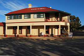 Hawker Hotel-Motel | |||||||||||||||
 Hawker | |||||||||||||||
| Coordinates | 31°53′28″S 138°25′20″E / 31.891074°S 138.422137°E / -31.891074; 138.422137Coordinates: 31°53′28″S 138°25′20″E / 31.891074°S 138.422137°E / -31.891074; 138.422137[1] | ||||||||||||||
| Population |
| ||||||||||||||
| Established | 1 July 1880 (town) 25 November 1999 (locality)[1][4] | ||||||||||||||
| Postcode(s) | 5434 | ||||||||||||||
| Elevation | 315 m (1,033 ft)[5] | ||||||||||||||
| Location | 365 km (227 mi) N of Adelaide | ||||||||||||||
| LGA(s) | Flinders Ranges Council | ||||||||||||||
| Region | Far North[1] | ||||||||||||||
| County | Blachford Hanson[1] | ||||||||||||||
| State electorate(s) | Stuart | ||||||||||||||
| Federal Division(s) | Grey | ||||||||||||||
| |||||||||||||||
| |||||||||||||||
| Footnotes | Adjoining localities[1] | ||||||||||||||
Hawker is a town and a locality in the Flinders Ranges area of South Australia, 365 kilometres (227 mi) north of Adelaide. It is in the Flinders Ranges Council, the state Electoral district of Stuart and the federal Division of Grey. At the 2016 census, the locality had a population of 341 of which 237 lived in its town centre.[2][3]
Contents
1 History
1.1 Heritage listings
2 Economy
3 Tourism
4 Climate
5 See also
6 References
7 External links
History
The town was surveyed during March 1880 and was proclaimed on 1 July 1880. It was named after G. C. Hawker who was a member of the South Australian Parliament for the years 1858-1865 and 1875-1883. The locality's boundaries were gazetted on 25 November 1999 and include the Government Towns of Wonoka, Hawker and Chapmanton. Portion of Hawker were added to the adjoining localities of Flinders Ranges and Shaggy Ridge on 26 November 2013.[1]
Hawker was a thriving railway town from the 1880s until 1956 as it was on the famous Ghan railway line, until the route was moved further west when the line was upgraded.[citation needed]
Heritage listings
Hawker has a number of heritage-listed sites, including:
- 20 Cradock Road: St Philip and St James Catholic Church [6]
- Hawker-Wilpena Road: Mount Desire Dyke [7]
- Wonoka-Hawker Road: Hawker railway station [8][9][10]
1885 Hawker Dam [11]
Economy
The main economic activities in the area are tourism and pastoral runs of sheep and increasingly cattle. Due to the arid environment, the stocking rates are low, at about one sheep per three to four hectares. Hawker is 55 kilometres (34 mi) south of Wilpena Pound, a unique natural dish-shaped range of hills popular with tourists, as well as the spectacular scenery of the Flinders Ranges.
Tourism
Hawker Racing Club holds a once a year Thoroughbred horse racing meeting which includes the Hawker Cup in late May which attracts many people from around the area.[12]
Climate
Hawker has a semi-arid climate with hot summers and cool winters. Rainfall is very sparse throughout the year, but more reliable in the winter months.
| ||||||||||||||||||||||||||||||||||||||||||||||||||||||||||||||||||||||||||||||||||||||||||||||||||||||||||||||||||||||||||||||
See also
- Hawker (disambiguation)
References
^ abcdef "Search results for 'Hawker, LOCB' with the following datasets selected - 'Suburbs and Localities', 'Counties', 'Hundreds', 'Government Towns' 'Local Government Areas', 'SA Government Regions' and 'Gazetteer'". Location SA Map Viewer. South Australian Government. Retrieved 27 January 2018..mw-parser-output cite.citation{font-style:inherit}.mw-parser-output q{quotes:"""""""'""'"}.mw-parser-output code.cs1-code{color:inherit;background:inherit;border:inherit;padding:inherit}.mw-parser-output .cs1-lock-free a{background:url("//upload.wikimedia.org/wikipedia/commons/thumb/6/65/Lock-green.svg/9px-Lock-green.svg.png")no-repeat;background-position:right .1em center}.mw-parser-output .cs1-lock-limited a,.mw-parser-output .cs1-lock-registration a{background:url("//upload.wikimedia.org/wikipedia/commons/thumb/d/d6/Lock-gray-alt-2.svg/9px-Lock-gray-alt-2.svg.png")no-repeat;background-position:right .1em center}.mw-parser-output .cs1-lock-subscription a{background:url("//upload.wikimedia.org/wikipedia/commons/thumb/a/aa/Lock-red-alt-2.svg/9px-Lock-red-alt-2.svg.png")no-repeat;background-position:right .1em center}.mw-parser-output .cs1-subscription,.mw-parser-output .cs1-registration{color:#555}.mw-parser-output .cs1-subscription span,.mw-parser-output .cs1-registration span{border-bottom:1px dotted;cursor:help}.mw-parser-output .cs1-hidden-error{display:none;font-size:100%}.mw-parser-output .cs1-visible-error{font-size:100%}.mw-parser-output .cs1-subscription,.mw-parser-output .cs1-registration,.mw-parser-output .cs1-format{font-size:95%}.mw-parser-output .cs1-kern-left,.mw-parser-output .cs1-kern-wl-left{padding-left:0.2em}.mw-parser-output .cs1-kern-right,.mw-parser-output .cs1-kern-wl-right{padding-right:0.2em}
^ ab Australian Bureau of Statistics (27 June 2017). "Hawker (Urban Centre/Locality)". 2016 Census QuickStats. Retrieved 23 January 2018.

^ ab Australian Bureau of Statistics (27 June 2017). "Hawker, SA (state suburb)". 2016 Census QuickStats. Retrieved 23 January 2018.
^ "GEOGRAPHICAL NAMES ACT 1991 Notice to Assign Boundaries and Names to Places" (PDF), The South Australian Government Gazette: 2442, 25 November 1999, retrieved 27 January 2018
^ abcde "Climate statistics for HAWKER". Bureau of Meteorology. Retrieved 21 January 2014.
^ "St Philip and St James Catholic Church". South Australian Heritage Register. Department of Environment, Water and Natural Resources. Archived from the original on 15 February 2016. Retrieved 12 February 2016.
^ "Mount Desire Dyke (designated place of geological significance)". South Australian Heritage Register. Department of Environment, Water and Natural Resources. Archived from the original on 15 February 2016. Retrieved 12 February 2016.
^ "Hawker Railway Station Complex - Goods Shed, Wool Platform and Crane". South Australian Heritage Register. Department of Environment, Water and Natural Resources. Archived from the original on 15 February 2016. Retrieved 12 February 2016.
^ "Hawker Railway Station Complex - Station Building". South Australian Heritage Register. Department of Environment, Water and Natural Resources. Archived from the original on 15 February 2016. Retrieved 12 February 2016.
^ "Hawker Railway Station Complex - Water Tank and Water Column". South Australian Heritage Register. Department of Environment, Water and Natural Resources. Archived from the original on 15 February 2016. Retrieved 12 February 2016.
^ "1885 Hawker Dam". South Australian Heritage Register. Department of Environment, Water and Natural Resources. Archived from the original on 15 February 2016. Retrieved 12 February 2016.
^ "Hawker Races & Cabaret". Hawker Community Development Board. May 2015. Retrieved 19 May 2015.
External links
- Official Hawker website
- Flinders Ranges website - Hawker


