Aurangabad district, Maharashtra
Aurangabad district | |
|---|---|
District of Maharashtra | |
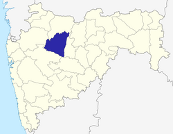 Location of Aurangabad district in Maharashtra | |
| Country | India |
| State | Maharashtra |
| Administrative division | Aurangabad Division |
| Headquarters | Aurangabad, Maharashtra |
| Tehsils | 1. Aurangabad, 2. Paithan, 3. Vaijapur, 4. Gangapur, 5. Khuldabad, 6. Phulambri, 7. Kannad, 8. Sillod, 9. Soegaon |
| Government | |
| • Lok Sabha constituencies | 1. Aurangabad, 2. Jalna (shared with Jalna district) (based on Election Commission website) |
| Area | |
| • Total | 10,100 km2 (3,900 sq mi) |
| Population (2011) | |
| • Total | 3,695,928 |
| • Density | 370/km2 (950/sq mi) |
| • Urban | 37.53% |
| Demographics | |
| • Literacy | 61.15% |
| • Sex ratio | 924 |
| Major highways | NH-211 |
| Average annual precipitation | 734 mm |
| Website | Official website |

Bibi Ka Maqbara is a monument built in 1660 by Aurangzeb's son, Azam Shah, as a loving tribute to his mother, Dilras Bano Begam.
Aurangabad District, also called one of the 36 districts of Maharashtra state in western India. It is bordered by the districts of Nashik to the west, Jalgaon to the north, Jalna to the east, and Ahmednagar to the south. Aurangabad is the headquarters and principal city. The district covers an area of 10,100 km², out of which 37.55% is urban and the remainder is rural. Aurangabad district is a major tourism region in Marathwada.
Contents
1 Geography
2 Geology
2.1 Mountains
2.2 Rivers
2.3 Climate
3 Economy
4 Divisions
5 Demographics
6 Transport
6.1 Road
6.2 Rail
6.3 Air
7 See also
8 References
9 External links
Geography
Aurangabad District is located mainly in the Godavari River Basin and partly in the Tapi River Basin. The district is located between 19 and 20 degrees north longitude, and 74 and 76 degrees east latitude.
Geology
Geologically the whole area is covered by the Deccan Trap lava flows of upper Cretaceous to lower Eocene age. The basaltic lava flows belonging to the Deccan Trap are the only major geological formation. The traps are overlain by thin alluvial deposits along the major rivers. The lava flows are horizontal and each flow has two distinct units. The upper layers consist of vesicular and amygdule zeolitic basalt, while the bottom layer consists of massive basalt.[1]
Mountains
- Antur –
827 m
- Satonda – 552 m
- Abbasgad – 671 m and Ajintha 578 m; average height of southern portion is 600–670 m
Rivers
The major rivers in Aurangabad district are the Godavari, Purna, Shivana, Maniyad, Sukhana, Kham, and the famous Shahbaz river.
The Narangi rises on the southern slopes of the water divide to the south of the Maniyad river, a little above Naral village, and flows past Vaijapur. Below the latter it is joined by the Deo nala, flowing from Nasik district. It has a fairly long south-southwesterly course before its point of entry into the Godavari is carried a little down the latter. It is joined by the Chor nala from the west and Kurla nala from the east. Actually the Narangi continues the trend of the Kurla river after the latter's confluence.
Climate
| Aurangabad | ||||||||||||||||||||||||||||||||||||||||||||||||||||||||||||
|---|---|---|---|---|---|---|---|---|---|---|---|---|---|---|---|---|---|---|---|---|---|---|---|---|---|---|---|---|---|---|---|---|---|---|---|---|---|---|---|---|---|---|---|---|---|---|---|---|---|---|---|---|---|---|---|---|---|---|---|---|
| Climate chart (explanation) | ||||||||||||||||||||||||||||||||||||||||||||||||||||||||||||
| ||||||||||||||||||||||||||||||||||||||||||||||||||||||||||||
| ||||||||||||||||||||||||||||||||||||||||||||||||||||||||||||
In Aurangabad district the rainy season runs from June to September. Winter is from approximately October to February and summer from March to May. The average rainfall of Aurangabad district is 734 mm, and the temperature range is about 6–46 degree Celsius.
| Climate data for Aurangabad | |||||||||||||
|---|---|---|---|---|---|---|---|---|---|---|---|---|---|
| Month | Jan | Feb | Mar | Apr | May | Jun | Jul | Aug | Sep | Oct | Nov | Dec | Year |
| Average high °C (°F) | 29.7 (85.5) | 32.5 (90.5) | 36.1 (97.0) | 39.0 (102.2) | 39.9 (103.8) | 34.9 (94.8) | 30.3 (86.5) | 29.1 (84.4) | 30.4 (86.7) | 32.6 (90.7) | 30.9 (87.6) | 29.3 (84.7) | 32.9 (91.2) |
| Average low °C (°F) | 14.2 (57.6) | 16.3 (61.3) | 20.2 (68.4) | 23.7 (74.7) | 24.6 (76.3) | 23.0 (73.4) | 21.8 (71.2) | 21.1 (70.0) | 20.9 (69.6) | 19.7 (67.5) | 16.4 (61.5) | 14.0 (57.2) | 19.7 (67.5) |
| Average precipitation mm (inches) | 2.2 (0.09) | 2.9 (0.11) | 5.1 (0.20) | 6.3 (0.25) | 25.5 (1.00) | 131.4 (5.17) | 167.0 (6.57) | 165.0 (6.50) | 135.3 (5.33) | 52.6 (2.07) | 29.3 (1.15) | 8.4 (0.33) | 731.0 (28.78) |
| Source: IMD | |||||||||||||
Economy
Companies operating out of Aurangabad District include:
- Bajaj Auto Ltd
- Videocon Industries (I) Pvt. Ltd
- Skoda Auto (I) P Ltd,
- Seimens Ltd.
- Crompton Greaves Ltd
- Dhoot Transmission Pvt. Ltd
Major manufacturing companies include:
- Bajaj Auto Limited
- Garware Polyester
- Videocon Industries Ltd.
- Skoda
Audi assembly- Siemens
- Perkins
- Hindalco
- Varroc
- Endurance
- Ceat Goodyear
- Orchid
- Lupin
- Ajanta Pharma
- Sabmiller
- Fosters
Cosmo Films Ltd.- Grind Master Machines Pvt Ltd
- Greaves
- Forbes Gokak
- Forbes Marshall
- Lombardini
Aurangabad has the following MIDC areas: Waluj, Shendra five star MIDC, Chikalthana, Paithan and Railway Station MIDC. There is a software technology park in Chikalthana MIDC.
Divisions
The district comprises nine tehsils: Kannad, Soygaon, Sillod, Phulambri, Aurangabad, Khultabad, Vaijapur, Gangapur and Paithan.
Nine Maharashtra Vidhan Sabha constituencies are located in this district: Sillod, Kannad, Pulambri, Aurangabad Central, Aurangabad West, Aurangabad East, Paithan, Gangapur and Vaijapur. Aurangabad is the only Lok Sabha constituency in this district.[2]
Demographics
According to the 2011 census Aurangabad district, Maharashtra has a population of 3,695,928,[3] roughly equal to the nation of Liberia[4] This gives it a ranking of 72nd in India (out of a total of 640).[3] The district has a population density of 365 inhabitants per square kilometre (950/sq mi).[3] Its population growth rate over the decade 2001-2011 was 27.33%.[3] Aurangabad has a sex ratio of 917 females for every 1000 males,[3] and a literacy rate of 80.4%.[3]
According to the 2001 Census, the total population of Aurangabad District is 2,897,013, and the main languages are Marathi, Hindi, English and Urdu. The population of the district is 37.53% urban as of 2001.[5]
Languages spoken include Ahirani, a Kandeshi tongue with approximately 780,000 speakers, similar to Marathi and Bhili;[6] and Andh, an Indo-Aryan language spoken by 100,000 people.[7]
Transport
Road
- Mumbai - Aurangabad
- Hyderabad - Aurangabad
- Nagpur - Aurangabad
- Aurangabad-Dhule
- Pune - Aurangabad (approximately 4.5 hours journey time)
Rail
The Manmad-Kachiguda Railway Station Broad gauge railway line which emanates from the Mumbai-Bhusawal-Howrah trunk route at Manmad is an important artery of traffic in Aurangabad district.
- Mumbai - Aurangabad
- Hyderabad - Nanded - Aurangabad
- Secunderabad - Bangalore - Parbhani - Aurangabad
- Delhi - Aurangabad - Delhi
- Nagpur - Aurangabad - Nagpur
- Mumbai-Aurangabad - Mumbai - Janshatabdi Express - daily service - up and down
- Nandigram Express - via - Aurangabad to Mumbai - daily service
- Devgiri Express - via - Aurangabad to Mumbai - daily service
- Tapovan Express - daily service
Air
Aurangabad Airport has flights to Delhi, Mumbai, Hyderabad-Tirupati & also to Jaipur.
See also
- Tourism in Marathwada
- Aurangzeb
References
^ K.R. Aher and S.M. Deshpande 'Assessment of Water Quality of the Maniyad Reservoir of Parala Village, district Aurangabad: Suitability for Multipurpose Usage', International Journal of Recent Trends in Science And Technology, Vol.1(3), pp 91-95, 2011, E-ISSN 2249-8109.
^ "District wise List of Assembly and Parliamentary Constituencies". Chief Electoral Officer, Maharashtra website. Archived from the original on 2009-02-25..mw-parser-output cite.citation{font-style:inherit}.mw-parser-output .citation q{quotes:"""""""'""'"}.mw-parser-output .citation .cs1-lock-free a{background:url("//upload.wikimedia.org/wikipedia/commons/thumb/6/65/Lock-green.svg/9px-Lock-green.svg.png")no-repeat;background-position:right .1em center}.mw-parser-output .citation .cs1-lock-limited a,.mw-parser-output .citation .cs1-lock-registration a{background:url("//upload.wikimedia.org/wikipedia/commons/thumb/d/d6/Lock-gray-alt-2.svg/9px-Lock-gray-alt-2.svg.png")no-repeat;background-position:right .1em center}.mw-parser-output .citation .cs1-lock-subscription a{background:url("//upload.wikimedia.org/wikipedia/commons/thumb/a/aa/Lock-red-alt-2.svg/9px-Lock-red-alt-2.svg.png")no-repeat;background-position:right .1em center}.mw-parser-output .cs1-subscription,.mw-parser-output .cs1-registration{color:#555}.mw-parser-output .cs1-subscription span,.mw-parser-output .cs1-registration span{border-bottom:1px dotted;cursor:help}.mw-parser-output .cs1-ws-icon a{background:url("//upload.wikimedia.org/wikipedia/commons/thumb/4/4c/Wikisource-logo.svg/12px-Wikisource-logo.svg.png")no-repeat;background-position:right .1em center}.mw-parser-output code.cs1-code{color:inherit;background:inherit;border:inherit;padding:inherit}.mw-parser-output .cs1-hidden-error{display:none;font-size:100%}.mw-parser-output .cs1-visible-error{font-size:100%}.mw-parser-output .cs1-maint{display:none;color:#33aa33;margin-left:0.3em}.mw-parser-output .cs1-subscription,.mw-parser-output .cs1-registration,.mw-parser-output .cs1-format{font-size:95%}.mw-parser-output .cs1-kern-left,.mw-parser-output .cs1-kern-wl-left{padding-left:0.2em}.mw-parser-output .cs1-kern-right,.mw-parser-output .cs1-kern-wl-right{padding-right:0.2em}
^ abcdef "District Census 2011". Census2011.co.in. 2011. Retrieved 2011-09-30.
^ US Directorate of Intelligence. "Country Comparison:Population". Retrieved 2011-10-01.Liberia 3,786,764 July 2011 est.
^ "Archived copy". Archived from the original on 2012-05-24. Retrieved 2008-03-12.CS1 maint: Archived copy as title (link)
^ M. Paul Lewis, ed. (2009). "Ahirani: A language of India". Ethnologue: Languages of the World (16th ed.). Dallas, Texas: SIL International. Retrieved 2011-09-28.
^ M. Paul Lewis, ed. (2009). "Andh: A language of India". Ethnologue: Languages of the World (16th ed.). Dallas, Texas: SIL International. Retrieved 2011-09-28.
External links
"District Aurangabad - Government of Maharashtra". Aurangabad.gov.in. Retrieved 12 March 2019.
Places adjacent to Aurangabad district, Maharashtra | ||||||||||
|---|---|---|---|---|---|---|---|---|---|---|
| ||||||||||
Largest city: Aurangabad Second largest: Nanded Third largest: Latur | |
| Districts of Marathwada |
|
| Cities with municipal corporations |
|
| Topics |
|
Portal: Maharashtra | |
Aurangabad district, Maharashtra topics | ||
|---|---|---|
| History |
|  |
| Geography |
| |
| Monuments |
| |
| Culture |
| |
| Education |
| |
| Transport |
| |
| Cities and towns |
| |
| Neighbourhoods |
| |
| Industrial Estates |
| |
Lok Sabha constituencies |
| |
Vidhan Sabha constituencies |
| |
| Judiciary |
| |
| Sports |
| |
| Other topics |
| |
Capital: Mumbai Second capital: Nagpur | |||||||||||||
| Topics |
| ||||||||||||
| Regions |
| ||||||||||||
| Divisions and Districts |
| ||||||||||||
| Million-plus cities in Maharashtra |
| ||||||||||||
| Other cities with municipal corporations |
| ||||||||||||
Portal: Maharashtra | |||||||||||||
Godavari basin | |||||||||||||||
|---|---|---|---|---|---|---|---|---|---|---|---|---|---|---|---|
| Rivers |
|     | |||||||||||||
| Dams, barrages |
| ||||||||||||||
| Geographical features / regions |
| ||||||||||||||
Riparian districts |
| ||||||||||||||
| Cities |
| ||||||||||||||
| Languages / people |
| ||||||||||||||
| Coalfields |
| ||||||||||||||
| Oil / gas fields |
| ||||||||||||||
| Industries |
| ||||||||||||||
| Transport |
| ||||||||||||||
| Pollution concerns, River basin's sustainable productivity & ecology |
| ||||||||||||||
| Related topics |
| ||||||||||||||
| Other basins |
| ||||||||||||||
Coordinates: 19°53′19.63″N 75°20′36.37″E / 19.8887861°N 75.3434361°E / 19.8887861; 75.3434361


