Safaga
Safaga سفاجا | |
|---|---|
City | |
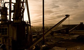 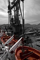 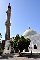 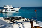 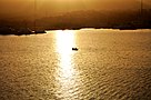 Clockwise from top: Industrial Safaga Port, Lifeboats on a docking ship, Safaga Mosque, Yachting in Safaga, Sunset over Safaga's coast | |
 Safaga Location in Egypt | |
| Coordinates: 26°44′N 33°56′E / 26.733°N 33.933°E / 26.733; 33.933 | |
| Country | |
| Governorate | Red Sea |
| Time zone | UTC+2 (EST) |
Port Safaga, also known as Safaga (Egyptian Arabic: سفاجا Safāga, IPA: [sæˈfæːɡæ]), is a town in Egypt, on the coast of the Red Sea, located 53 km (33 mi) south of Hurghada. This small port is also a tourist area that consists of several bungalows and rest houses, including the Safaga Hotel, with a capacity of 48 rooms (126 beds).
Having numerous phosphate mines, it is regarded as the phosphates export center. A paved road of 164 km (102 mi) connects Safaga to Qena of Upper Egypt.
This port is also a gateway for Duba port to some pilgrims or travelers to Arabia, by ferries.
Contents
1 History
2 Climate
3 See also
4 References
History
Safaga was a marine port connected by a regular cruise shuttle service line. The port town was founded between 282 BC and 268 BC, originally called Philotera (Φιλοτέρα) by the Greek Egyptian Pharaoh Ptolemy II Philadelphus, who named the town in honor of his deceased sister. Safaga City is considered one of the most important therapeutic tourist centres, as special medical researches have proved the potential of attracting international tourism to Safaga.
Safaga was a merchant port for many years. The town has a small tourism industry, specialising in scuba diving. It was the host of the 1993 Red Sea World Windsurfing Championships.
Climate
Köppen-Geiger climate classification system classifies its climate as hot desert (BWh),[1] as the rest of Egypt.
The highest record temperature was 46 °C (115 °F) on July 30, 2002, while the lowest record temperature was 0 °C (32 °F) on February 2, 1993.[2]
| Climate data for Safaga | |||||||||||||
|---|---|---|---|---|---|---|---|---|---|---|---|---|---|
| Month | Jan | Feb | Mar | Apr | May | Jun | Jul | Aug | Sep | Oct | Nov | Dec | Year |
| Record high °C (°F) | 33 (91) | 34 (93) | 38 (100) | 42 (108) | 43 (109) | 46 (115) | 46 (115) | 44 (111) | 43 (109) | 43 (109) | 35 (95) | 34 (93) | 46 (115) |
| Average high °C (°F) | 21.9 (71.4) | 22.7 (72.9) | 26.1 (79.0) | 28.1 (82.6) | 31.7 (89.1) | 33.8 (92.8) | 34 (93) | 34.4 (93.9) | 32.3 (90.1) | 30.2 (86.4) | 27 (81) | 23.4 (74.1) | 28.8 (83.9) |
| Daily mean °C (°F) | 16.3 (61.3) | 16.8 (62.2) | 20.4 (68.7) | 22.5 (72.5) | 26.2 (79.2) | 28.6 (83.5) | 29 (84) | 29.6 (85.3) | 27.6 (81.7) | 25.2 (77.4) | 21.6 (70.9) | 17.9 (64.2) | 23.5 (74.2) |
| Average low °C (°F) | 10.7 (51.3) | 11 (52) | 14.8 (58.6) | 16.9 (62.4) | 20.7 (69.3) | 23.5 (74.3) | 24.1 (75.4) | 24.9 (76.8) | 22.9 (73.2) | 20.3 (68.5) | 16.3 (61.3) | 12.4 (54.3) | 18.2 (64.8) |
| Record low °C (°F) | 1 (34) | 0 (32) | 1 (34) | 8 (46) | 10 (50) | 12 (54) | 15 (59) | 13 (55) | 12 (54) | 11 (52) | 6 (43) | 3 (37) | 0 (32) |
| Average precipitation mm (inches) | 0 (0) | 0 (0) | 0 (0) | 0 (0) | 0 (0) | 0 (0) | 0 (0) | 0 (0) | 0 (0) | 1 (0.0) | 1 (0.0) | 0 (0) | 2 (0) |
| Average rainy days | 0 | 0 | 0 | 0 | 1 | 0 | 0 | 0 | 0 | 0 | 0 | 0 | 1 |
| Mean daily sunshine hours | 9 | 10 | 10 | 10 | 11 | 12 | 13 | 12 | 11 | 10 | 10 | 9 | 11 |
| Source #1: Climate-Data.org (altitude: 18m),[1]Weather2Travel for rainy days and sunshine[3] | |||||||||||||
| Source #2: Voodoo Skies for record temperatures[2] | |||||||||||||
| Jan | Feb | Mar | Apr | May | Jun | Jul | Aug | Sep | Oct | Nov | Dec |
|---|---|---|---|---|---|---|---|---|---|---|---|
| 23 °C (73 °F) | 22 °C (72 °F) | 22 °C (72 °F) | 23 °C (73 °F) | 25 °C (77 °F) | 26 °C (79 °F) | 28 °C (82 °F) | 29 °C (84 °F) | 28 °C (82 °F) | 27 °C (81 °F) | 26 °C (79 °F) | 24 °C (75 °F) |
See also
- List of cities and towns in Egypt
- Gamul Kebir
References
^ ab "Climate: Port Safaga - Climate graph, Temperature graph, Climate table". Climate-Data.org. Archived from the original on 5 November 2013. Retrieved 13 August 2013..mw-parser-output cite.citation{font-style:inherit}.mw-parser-output .citation q{quotes:"""""""'""'"}.mw-parser-output .citation .cs1-lock-free a{background:url("//upload.wikimedia.org/wikipedia/commons/thumb/6/65/Lock-green.svg/9px-Lock-green.svg.png")no-repeat;background-position:right .1em center}.mw-parser-output .citation .cs1-lock-limited a,.mw-parser-output .citation .cs1-lock-registration a{background:url("//upload.wikimedia.org/wikipedia/commons/thumb/d/d6/Lock-gray-alt-2.svg/9px-Lock-gray-alt-2.svg.png")no-repeat;background-position:right .1em center}.mw-parser-output .citation .cs1-lock-subscription a{background:url("//upload.wikimedia.org/wikipedia/commons/thumb/a/aa/Lock-red-alt-2.svg/9px-Lock-red-alt-2.svg.png")no-repeat;background-position:right .1em center}.mw-parser-output .cs1-subscription,.mw-parser-output .cs1-registration{color:#555}.mw-parser-output .cs1-subscription span,.mw-parser-output .cs1-registration span{border-bottom:1px dotted;cursor:help}.mw-parser-output .cs1-ws-icon a{background:url("//upload.wikimedia.org/wikipedia/commons/thumb/4/4c/Wikisource-logo.svg/12px-Wikisource-logo.svg.png")no-repeat;background-position:right .1em center}.mw-parser-output code.cs1-code{color:inherit;background:inherit;border:inherit;padding:inherit}.mw-parser-output .cs1-hidden-error{display:none;font-size:100%}.mw-parser-output .cs1-visible-error{font-size:100%}.mw-parser-output .cs1-maint{display:none;color:#33aa33;margin-left:0.3em}.mw-parser-output .cs1-subscription,.mw-parser-output .cs1-registration,.mw-parser-output .cs1-format{font-size:95%}.mw-parser-output .cs1-kern-left,.mw-parser-output .cs1-kern-wl-left{padding-left:0.2em}.mw-parser-output .cs1-kern-right,.mw-parser-output .cs1-kern-wl-right{padding-right:0.2em}
^ ab "Safaga, Egypt". Voodoo Skies. Archived from the original on 2014-01-16. Retrieved 2014-01-15.
^ ab "Safaga Climate and Weather Averages, Egypt". Weather2Travel. Archived from the original on 2014-10-07. Retrieved 2014-01-15.
Coordinates: 26°44′N 33°56′E / 26.733°N 33.933°E / 26.733; 33.933
| 1,000,000 and more |
|
|---|---|
| 300,000–999,999 |
|
| 100,000–299,999 |
|
| <99,999 |
|
Authority control |
|
|---|


