Ellis County, Texas
Ellis County, Texas | |
|---|---|
 The Ellis County Courthouse in Waxahachie | |
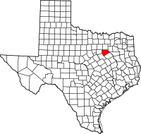 Location in the U.S. state of Texas | |
 Texas's location in the U.S. | |
| Founded | 1850 |
| Named for | Richard Ellis |
| Seat | Waxahachie |
| Largest city | Waxahachie |
| Area | |
| • Total | 952 sq mi (2,466 km2) |
| • Land | 936 sq mi (2,424 km2) |
| • Water | 16 sq mi (41 km2), 1.7% |
| Population | |
| • (2010) | 149,610 |
| • Density | 160/sq mi (60/km2) |
| Congressional district | 6th |
| Time zone | Central: UTC−6/−5 |
| Website | www.co.ellis.tx.us |

Across from the courthouse is the Ellis County Museum.
Ellis County is a county located in the U.S. state of Texas. As of the 2010 census, its population was 149,610.[1] The county seat is Waxahachie.[2] The county was founded in 1849 and organized the next year.[3] It is named for Richard Ellis,[4] president of the convention that produced the Texas Declaration of Independence.
Ellis County is included in the Dallas-Fort Worth-Arlington, TX Metropolitan Statistical Area.
Contents
1 Geography
1.1 Major highways
1.2 Adjacent counties
2 Demographics
3 Politics
4 Media
5 Communities
5.1 Cities (multiple counties)
5.2 Cities
5.3 Towns
5.4 Census-designated place
5.5 Unincorporated communities
6 Notable people
7 See also
8 References
9 External links
Geography
According to the U.S. Census Bureau, the county has a total area of 952 square miles (2,470 km2), of which 935 square miles (2,420 km2) is land and 16 square miles (41 km2) (1.7%) is water.[5]
Major highways
 Interstate 35E
 Interstate 45
 U.S. Route 67
 U.S. 77
 U.S. 287
 State Highway 34
 State Highway 342
Adjacent counties
Dallas County (north)
Kaufman County (northeast)
Henderson County (east)
Navarro County (southeast)
Hill County (southwest)
Johnson County (west)
Tarrant County (northwest)
Demographics
| Historical population | |||
|---|---|---|---|
| Census | Pop. | %± | |
| 1850 | 989 | — | |
| 1860 | 5,246 | 430.4% | |
| 1870 | 7,514 | 43.2% | |
| 1880 | 21,294 | 183.4% | |
| 1890 | 31,774 | 49.2% | |
| 1900 | 50,059 | 57.5% | |
| 1910 | 53,629 | 7.1% | |
| 1920 | 55,700 | 3.9% | |
| 1930 | 53,936 | −3.2% | |
| 1940 | 47,733 | −11.5% | |
| 1950 | 45,645 | −4.4% | |
| 1960 | 43,395 | −4.9% | |
| 1970 | 46,638 | 7.5% | |
| 1980 | 59,743 | 28.1% | |
| 1990 | 85,167 | 42.6% | |
| 2000 | 111,360 | 30.8% | |
| 2010 | 149,610 | 34.3% | |
| Est. 2016 | 168,499 | [6] | 12.6% |
| U.S. Decennial Census[7] 1850–2010[8] 2010–2014[1] | |||
As of the census[9] of 2000, there were 111,360 people, 37,020 households, and 29,653 families residing in the county. The population density was 118 people per square mile (46/km²). There were 39,071 housing units at an average density of 42 per square mile (16/km²). The racial makeup of the county was 80.63% White, 8.64% Black or African American, 0.59% Native American, 0.35% Asian, 0.02% Pacific Islander, 7.90% from other races, and 1.86% from two or more races. 18.42% of the population were Hispanic or Latino of any race.
There were 37,020 households out of which 42.10% had children under the age of 18 living with them, 64.80% were married couples living together, 11.00% had a female householder with no husband present, and 19.90% were non-families. 16.60% of all households were made up of individuals and 6.50% had someone living alone who was 65 years of age or older. The average household size was 2.96 and the average family size was 3.31.
A Williams Institute analysis of 2010 census data found there were about 3.2 same-sex couples per 1,000 households in the county.[10]
In the county, the population was spread out with 30.20% under the age of 18, 9.30% from 18 to 24, 29.80% from 25 to 44, 21.50% from 45 to 64, and 9.20% who were 65 years of age or older. The median age was 33 years. For every 100 females, there were 98.30 males. For every 100 females age 18 and over, there were 95.40 males.
The median income for a household in the county was $50,350, and the median income for a family was $55,358. Males had a median income of $37,613 versus $26,612 for females. The per capita income for the county was $20,212. About 6.80% of families and 8.60% of the population were below the poverty line, including 11.10% of those under age 18 and 10.40% of those age 65 or over.
Politics
Ellis is a staunchly Republican county in presidential elections. The last Democratic presidential candidate to carry the county was Jimmy Carter in 1976, and since 2000, Republican presidential candidates have won with more than two-thirds of the vote.
| Year | Republican | Democratic | Third parties |
|---|---|---|---|
2016 | 70.1% 44,941 | 25.4% 16,253 | 4.6% 2,916 |
2012 | 72.9% 39,574 | 25.6% 13,881 | 1.5% 799 |
2008 | 70.7% 38,078 | 28.5% 15,333 | 0.8% 442 |
2004 | 74.5% 34,602 | 25.1% 11,640 | 0.4% 202 |
2000 | 69.9% 26,091 | 28.5% 10,629 | 1.6% 587 |
1996 | 53.9% 16,046 | 36.4% 10,832 | 9.7% 2,888 |
1992 | 40.5% 13,564 | 28.5% 9,537 | 31.0% 10,394 |
1988 | 59.2% 16,422 | 40.3% 11,169 | 0.6% 158 |
1984 | 67.6% 16,873 | 32.2% 8,029 | 0.3% 72 |
1980 | 51.3% 10,046 | 47.1% 9,219 | 1.6% 315 |
1976 | 41.0% 6,996 | 58.6% 9,991 | 0.4% 68 |
1972 | 69.5% 8,779 | 30.4% 3,839 | 0.1% 8 |
1968 | 31.4% 3,794 | 45.0% 5,431 | 23.6% 2,842 |
1964 | 27.6% 2,779 | 72.3% 7,278 | 0.1% 5 |
1960 | 38.4% 3,666 | 61.2% 5,841 | 0.4% 36 |
1956 | 40.7% 3,585 | 59.1% 5,211 | 0.3% 24 |
1952 | 39.9% 4,183 | 59.9% 6,275 | 0.2% 24 |
1948 | 13.8% 1,055 | 75.6% 5,792 | 10.7% 818 |
1944 | 8.0% 666 | 85.1% 7,065 | 6.9% 573 |
1940 | 8.1% 692 | 91.9% 7,881 | 0.1% 5 |
1936 | 5.3% 319 | 94.5% 5,644 | 0.2% 12 |
1932 | 6.9% 527 | 92.5% 7,033 | 0.6% 44 |
1928 | 44.7% 3,569 | 55.1% 4,399 | 0.2% 13 |
1924 | 13.5% 1,220 | 84.9% 7,678 | 1.6% 142 |
1920 | 14.0% 819 | 69.7% 4,081 | 16.3% 957 |
1916 | 6.3% 324 | 92.0% 4,718 | 1.7% 85 |
1912 | 7.4% 293 | 88.2% 3,483 | 4.3% 171 |
Media
Ellis County is part of the Dallas/Fort Worth Television media market in North Central Texas. Local News media outlets are: KDFW-TV, KXAS-TV, WFAA-TV, KTVT-TV, KERA-TV, KTXA-TV, KDFI-TV, KDAF-TV, KFWD-TV, and KDTX-TV.
Communities

Bardwell Dam and Lake in Ellis County near the town of Ennis
Ellis County Courts building
Cities (multiple counties)
Cedar Hill (mostly in Dallas County)
Ferris (small part in Dallas County)
Glenn Heights (partly in Dallas County)
Grand Prairie (mostly in Dallas and Tarrant counties)
Mansfield (mostly in Tarrant County and a small part in Johnson County)
Ovilla (small part in Dallas County)
Cities
- Bardwell
- Ennis
- Maypearl
- Midlothian
- Oak Leaf
- Pecan Hill
- Red Oak
Waxahachie (county seat)
Towns
- Alma
- Garrett
- Italy
- Milford
- Palmer
Venus (mostly in Johnson County)
Census-designated place
- Bristol
Unincorporated communities
- Auburn
- Avalon
- Crisp
- Forreston
- Ike
- India
- Rankin
- Rockett
- Telico
Notable people
Clyde Barrow of Bonnie and Clyde
J. D. Grey, clergyman, pastor of Tabernacle Baptist Church in Ennis, 1931-1934; later president of the Southern Baptist Convention
Ernest Tubb, country singer and songwriter
Donnie Fleeman professional light-heavyweight boxer, only Ellis County native to fight 3 world champion heavyweights; Sonny Liston, Ezzard Charles, and Muhammad Ali (formerly Cassius Clay). 47 national/international fights in his professional career. 37 wins, 22 KOs. Won State Heavyweight Title (Golden Gloves) in 1953 - contender for National Heavyweight Title, but lost to Sonny Liston. Cassius Clay (Muhammad Ali) was Fleeman's last professional fight, and took place in Miami, FL in 1961. This was Clay's 5th professional fight. [1]
- Lecil Travis Martin, known more commonly as Boxcar Willie
See also
- List of museums in North Texas
- National Register of Historic Places listings in Ellis County, Texas
- Recorded Texas Historic Landmarks in Ellis County
References
^ ab "State & County QuickFacts". United States Census Bureau. Archived from the original on July 9, 2011. Retrieved December 10, 2013..mw-parser-output cite.citation{font-style:inherit}.mw-parser-output q{quotes:"""""""'""'"}.mw-parser-output code.cs1-code{color:inherit;background:inherit;border:inherit;padding:inherit}.mw-parser-output .cs1-lock-free a{background:url("//upload.wikimedia.org/wikipedia/commons/thumb/6/65/Lock-green.svg/9px-Lock-green.svg.png")no-repeat;background-position:right .1em center}.mw-parser-output .cs1-lock-limited a,.mw-parser-output .cs1-lock-registration a{background:url("//upload.wikimedia.org/wikipedia/commons/thumb/d/d6/Lock-gray-alt-2.svg/9px-Lock-gray-alt-2.svg.png")no-repeat;background-position:right .1em center}.mw-parser-output .cs1-lock-subscription a{background:url("//upload.wikimedia.org/wikipedia/commons/thumb/a/aa/Lock-red-alt-2.svg/9px-Lock-red-alt-2.svg.png")no-repeat;background-position:right .1em center}.mw-parser-output .cs1-subscription,.mw-parser-output .cs1-registration{color:#555}.mw-parser-output .cs1-subscription span,.mw-parser-output .cs1-registration span{border-bottom:1px dotted;cursor:help}.mw-parser-output .cs1-hidden-error{display:none;font-size:100%}.mw-parser-output .cs1-visible-error{font-size:100%}.mw-parser-output .cs1-subscription,.mw-parser-output .cs1-registration,.mw-parser-output .cs1-format{font-size:95%}.mw-parser-output .cs1-kern-left,.mw-parser-output .cs1-kern-wl-left{padding-left:0.2em}.mw-parser-output .cs1-kern-right,.mw-parser-output .cs1-kern-wl-right{padding-right:0.2em}
^ "Find a County". National Association of Counties. Archived from the original on 2011-05-31. Retrieved 2011-06-07.
^ "Texas: Individual County Chronologies". Texas Atlas of Historical County Boundaries. The Newberry Library. 2008. Retrieved May 23, 2015.
^ Gannett, Henry (1905). The Origin of Certain Place Names in the United States. Govt. Print. Off. p. 117.
^ "2010 Census Gazetteer Files". United States Census Bureau. August 22, 2012. Retrieved April 26, 2015.
^ "Population and Housing Unit Estimates". Retrieved June 9, 2017.
^ "U.S. Decennial Census". United States Census Bureau. Archived from the original on May 12, 2015. Retrieved April 26, 2015.
^ "Texas Almanac: Population History of Counties from 1850–2010" (PDF). Texas Almanac. Retrieved April 26, 2015.
^ "American FactFinder". United States Census Bureau. Archived from the original on 2013-09-11. Retrieved 2011-05-14.
^ Where Same-Sex Couples Live, June 26, 2015, retrieved July 6, 2015
^ Leip, David. "Dave Leip's Atlas of U.S. Presidential Elections". uselectionatlas.org. Retrieved 2018-07-22.
External links
- Ellis County government's website
Ellis County from the Handbook of Texas Online
Memorial and biographical history of Ellis county, Texas ...[permanent dead link], published 1892, hosted by the Portal to Texas History
The Texas spirit of '17: a pictorial and biographical record of the gallant and courageous men from Ellis County who served in the Great War[permanent dead link], hosted by the Portal to Texas History
Places adjacent to Ellis County, Texas | ||||||||||
|---|---|---|---|---|---|---|---|---|---|---|
| ||||||||||
Municipalities and communities of Ellis County, Texas, United States | ||
|---|---|---|
County seat: Waxahachie | ||
| Cities |
|  |
| Towns |
| |
| CDP |
| |
| Unincorporated communities |
| |
| Footnotes | ‡This populated place also has portions in an adjacent county or counties | |
|
Austin (capital) | ||
| Topics |
|  Seal of Texas |
| Society |
| |
| Regions |
| |
| Metropolitan areas |
| |
| Counties | See: List of counties in Texas | |
Coordinates: 32°21′N 96°47′W / 32.35°N 96.79°W / 32.35; -96.79


