Kohat District
Kohat District | |
|---|---|
District | |
| Country | Pakistan |
| Province | Khyber Pakhtunkhwa Province |
| Headquarters | Kohat |
| Area | |
| • Total | 2,545 km2 (983 sq mi) |
| Population (2017)[1] | |
| • Total | 993,874 |
| • Density | 390/km2 (1,000/sq mi) |
| Time zone | UTC+5 (PST) |
Kohat District (Urdu: ضلع کوہاٹ) is a district of the Khyber Pakhtunkhwa province of Pakistan, Kohat city is the capital of the district.
Contents
1 Languages
1.1 Mughal era
2 Administration
3 References
4 Bibliography
Languages
The major languages in the district are Pashto, spoken by 75% of the population, and Hindko – spoken by 20%.[2] The Hindko dialect of this district is Kohati and it is confined to the city of Kohat and a string of villages running east along the road to Kushalgarh on the Indus.[3] There is also a group of native speakers of Urdu (0.8%) and Punjabi (4%).[4]
Mughal era
From the early sixteenth century the history of Kohat revolves around three major tribes namely Bangash, Banoori, and Afridi.[5] These people appear to have settled in the district, during 14th and 15th centuries. From 16th to 18th centuries, Kohat being part of Mughal Empire was administered by the Chiefs of two afore mentioned tribes. In the beginning of the 19th century Kohat came under the control of Sikhs who ultimately withdrew leaving to the administrative control of Khan of Teri in 1836.
Administration
Kohat district is divided into two Tehsils:
- Kohat
Lachi (Lachi is one of the largest village of Kohat. Situated on the southern border with Karak district)
The district is represented in the provincial assembly by three elected MPAs who represent the following constituencies:[6]
- PF-37 (Kohat-1)
- PF-38 (Kohat-2)
- PF-39 (Kohat-3)
- NA-14 (Kohat)
References
^ "DISTRICT WISE CENSUS RESULTS CENSUS 2017" (PDF). www.pbscensus.gov.pk..mw-parser-output cite.citation{font-style:inherit}.mw-parser-output q{quotes:"""""""'""'"}.mw-parser-output code.cs1-code{color:inherit;background:inherit;border:inherit;padding:inherit}.mw-parser-output .cs1-lock-free a{background:url("//upload.wikimedia.org/wikipedia/commons/thumb/6/65/Lock-green.svg/9px-Lock-green.svg.png")no-repeat;background-position:right .1em center}.mw-parser-output .cs1-lock-limited a,.mw-parser-output .cs1-lock-registration a{background:url("//upload.wikimedia.org/wikipedia/commons/thumb/d/d6/Lock-gray-alt-2.svg/9px-Lock-gray-alt-2.svg.png")no-repeat;background-position:right .1em center}.mw-parser-output .cs1-lock-subscription a{background:url("//upload.wikimedia.org/wikipedia/commons/thumb/a/aa/Lock-red-alt-2.svg/9px-Lock-red-alt-2.svg.png")no-repeat;background-position:right .1em center}.mw-parser-output .cs1-subscription,.mw-parser-output .cs1-registration{color:#555}.mw-parser-output .cs1-subscription span,.mw-parser-output .cs1-registration span{border-bottom:1px dotted;cursor:help}.mw-parser-output .cs1-hidden-error{display:none;font-size:100%}.mw-parser-output .cs1-visible-error{font-size:100%}.mw-parser-output .cs1-subscription,.mw-parser-output .cs1-registration,.mw-parser-output .cs1-format{font-size:95%}.mw-parser-output .cs1-kern-left,.mw-parser-output .cs1-kern-wl-left{padding-left:0.2em}.mw-parser-output .cs1-kern-right,.mw-parser-output .cs1-kern-wl-right{padding-right:0.2em}
^ The figures for Kohat tehsil are from PCO (1981, p. 86), which collected data for "mother languages" at the level of the household.
^ Shackle 1980, p. 485.
^ PCO 1981, p. 86.
^ History of Kohat
^ Constituencies and MPAs – Website of the Provincial Assembly of the NWFP Archived 2008-03-27 at the Wayback Machine.
Bibliography
1981 District Census report of Kohat. District Census Report. 27. Islamabad: Population Census Organization, Statistics Division, Government of Pakistan. 1983.
1998 District Census report of Kohat. Census publication. 42. Islamabad: Population Census Organization, Statistics Division, Government of Pakistan. 1999.
Shackle, Christopher (1980). "Hindko in Kohat and Peshawar". Bulletin of the School of Oriental and African Studies. 43 (3): 482–510. doi:10.1017/S0041977X00137401. ISSN 0041-977X.
Districts of Khyber Pakhtunkhwa | ||
|---|---|---|
Provincial capital: Peshawar | ||
| Divisions | Districts | 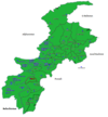 |
| Bannu |
| |
| Dera Ismail Khan |
| |
| Hazara |
| |
| Kohat |
| |
| Malakand |
| |
| Mardan |
| |
| Peshawar |
| |
Administrative divisions of Kohat District | ||
|---|---|---|
| Capital | Kohat | |
| Tehsils | ||
| Union councils |
| |
Coordinates: 33°20′N 71°10′E / 33.333°N 71.167°E / 33.333; 71.167


